Earthquake Minahassa Peninsula, Sulawesi
Thu, 29 Jan 2026 07:37:27 GMT
Time1 hour ago
Location
1.5436, 123.3810
Depth
5.8 KM
Event Summary
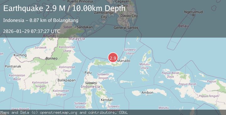
A 2.7 magnitude earthquake struck on Minahassa Peninsula, Sulawesi, at Thu, 29 Jan 2026 07:37:27 GMT. Depth: 5.765377km. Reviewed by BMKG seismologists, this minor quake occurred at a magnitude type of M.
Magnitude
2.7
M
Source
BMKG
Intensity
-
Agency Reports
1 Sources| Source | Magnitude | Depth | Time |
|---|---|---|---|
| BMKGPrimary | 2.7 | 6 km | 1 hour ago |
Earthquake Details
AutomaticEvent IDbmg2026bzte
Tsunami PotentialNo
Magnitude TypeM
Nearest Places
- Josina Reefs59.8 km
- Pulau Bangkil62.3 km
- Karang-karang Alanga66.9 km
- Haitia Dulang67.2 km
- Luwokia Dolongulu68.1 km
Comments
Join the discussion about this event.
Latest Earthquakes
2.4Mag
Halmahera, Indonesia
Time2 hours ago
Depth9.64 km
SourceBMKG (Automatic)
1.2Mag
3 km ESE of Lake Henshaw, CA
Time2 hours ago
Depth11.52 km
SourceUSGS (Automatic)
2.5Mag
Bali Sea
Time2 hours ago
Depth22.43 km
SourceBMKG (Automatic)
3.6Mag
OFF COAST OF AISEN, CHILE
Time2 hours ago
Depth10.00 km
SourceCSN (Automatic)
2.3Mag
WESTERN TURKEY
Time2 hours ago
Depth7.90 km
SourceKOERI (Automatic)
Nearby Earthquakes
3.4Mag
Minahassa Peninsula, Sulawesi
Time7 hours ago
Depth15.68 km
SourceBMKG (Automatic)
4.5Mag
Minahassa Peninsula, Sulawesi
Time11 hours ago
Depth10.00 km
SourceBMKG (Automatic)
4.8Mag
Minahassa Peninsula, Sulawesi
Time14 hours ago
Depth9.02 km
SourceBMKG (Automatic)
3.2Mag
Minahassa Peninsula, Sulawesi
Time12 hours ago
Depth10.00 km
SourceBMKG (Automatic)
3.0Mag
Minahassa Peninsula, Sulawesi
Time2 days ago
Depth10.59 km
SourceBMKG (Automatic)