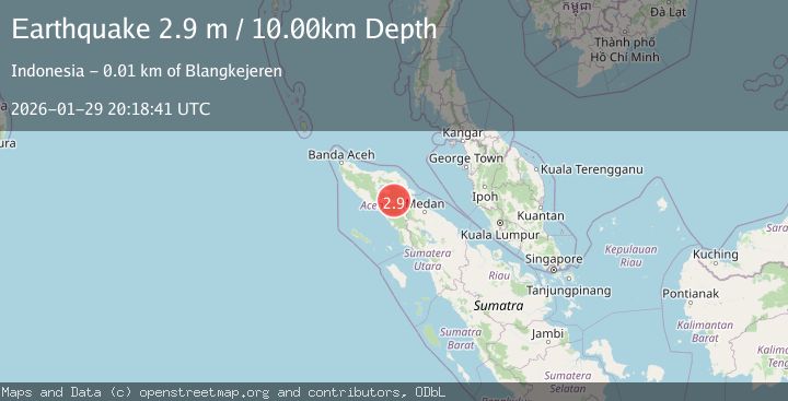
Earthquake Northern Sumatra, Indonesia
Thu, 29 Jan 2026 20:18:41 GMT
Time5 hours ago
Location
4.0473, 97.4468
Depth
10.0 KM
Event Summary
A 2.9 magnitude earthquake struck on Northern Sumatra, Indonesia, at Thu, 29 Jan 2026 20:18:41 GMT. Depth: 10km. Reviewed by BMKG seismologists, this minor quake occurred at a magnitude type of M.
Magnitude
2.9
M
Source
BMKG
Intensity
-
Agency Reports
1 Sources| Source | Magnitude | Depth | Time |
|---|---|---|---|
| BMKGPrimary | 2.9 | 10 km | 5 hours ago |
Earthquake Details
AutomaticEvent IDbmg2026cash
Tsunami PotentialNo
Magnitude TypeM
Nearest Places
- Waih Gajah0.8 km
- Gajah2.2 km
- Waih Ni Porotan2.3 km
- Waih Uring2.4 km
- Oreng2.7 km
Comments
Join the discussion about this event.
Latest Earthquakes
1.9Mag
2 km E of South Whittier, CA
Time6 hours ago
Depth18.88 km
SourceUSGS (Automatic)
2.4Mag
Sumbawa Region, Indonesia
Time6 hours ago
Depth10.10 km
SourceBMKG (Automatic)
1.6Mag
WESTERN TURKEY
Time6 hours ago
Depth11.00 km
SourceAFAD (Automatic)
2.9Mag
Northern Molucca Sea
Time6 hours ago
Depth10.00 km
SourceBMKG (Automatic)
2.8Mag
21 km SSW of Mammoth, Wyoming
Time6 hours ago
Depth25.82 km
SourceUSGS (Automatic)
Nearby Earthquakes
4.3Mag
Northern Sumatra, Indonesia
Time1 week ago
Depth10.00 km
SourceBMKG (Automatic)
2.2Mag
Northern Sumatra, Indonesia
Time6 days ago
Depth2.00 km
SourceBMKG (Automatic)
2.8Mag
Northern Sumatra, Indonesia
Time1 week ago
Depth5.00 km
SourceBMKG (Automatic)
2.6Mag
Northern Sumatra, Indonesia
Time13 hours ago
Depth5.00 km
SourceBMKG (Automatic)
2.4Mag
Northern Sumatra, Indonesia
Time4 days ago
Depth5.00 km
SourceBMKG (Automatic)