Earthquake Tanimbar Islands Region, Indonesia
Thu, 29 Jan 2026 20:49:45 GMT
Time2 hours ago
Location
-7.4091, 130.0283
Depth
10.0 KM
Event Summary
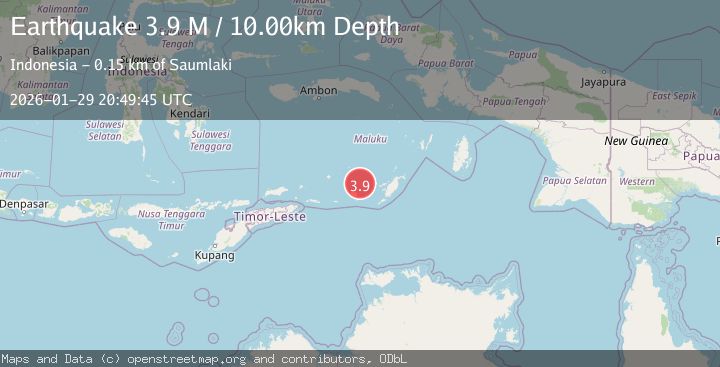
A 3.9 magnitude earthquake struck on Tanimbar Islands Region, Indonesia, at Thu, 29 Jan 2026 20:49:45 GMT. Depth: 10km. Reviewed by BMKG seismologists, this minor quake occurred at a magnitude type of M.
Magnitude
3.9
M
Source
BMKG
Intensity
-
Agency Reports
1 Sources| Source | Magnitude | Depth | Time |
|---|---|---|---|
| BMKGPrimary | 3.9 | 10 km | 2 hours ago |
Earthquake Details
AutomaticEvent IDbmg2026cati
Tsunami PotentialNo
Magnitude TypeM
Nearest Places
- Welora32.7 km
- Ilhar33.1 km
- Desa Welora33.8 km
- Pulau Dawera34.7 km
- Desa Letmasa36.1 km
Comments
Join the discussion about this event.
Latest Earthquakes
3.2Mag
COQUIMBO, CHILE
Time2 hours ago
Depth16.10 km
SourceCSN (Automatic)
1.2Mag
WESTERN TURKEY
Time2 hours ago
Depth7.00 km
SourceAFAD (Automatic)
2.9Mag
Sulawesi, Indonesia
Time2 hours ago
Depth5.00 km
SourceBMKG (Automatic)
2.6Mag
CHHATTISGARH, INDIA
Time2 hours ago
Depth10.00 km
SourceNDI (Automatic)
1.7Mag
13 km SSE of Volcano, Hawaii
Time2 hours ago
Depth4.26 km
SourceUSGS (Automatic)
Nearby Earthquakes
3.6Mag
Tanimbar Islands Region, Indonesia
Time2 days ago
Depth224.21 km
SourceBMKG (Automatic)
5.0Mag
Tanimbar Islands Region, Indonesia
Time1 day ago
Depth28.16 km
SourceBMKG (Automatic)
5.9Mag
Banda Sea
Time1 week ago
Depth102.35 km
SourceBMKG (Automatic)
4.5Mag
Banda Sea
Time1 week ago
Depth137.79 km
SourceUSGS
4.4Mag
Banda Sea
Time4 days ago
Depth141.54 km
SourceBMKG (Automatic)