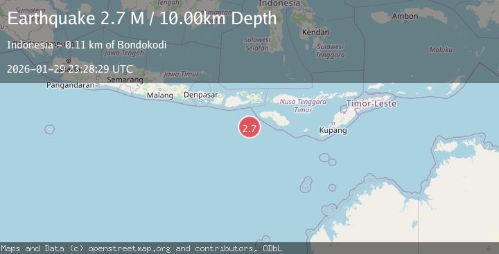
Earthquake South of Sumbawa, Indonesia
Thu, 29 Jan 2026 23:28:30 GMT
Time6 hours ago
Location
-10.2486, 118.4260
Depth
10.0 KM
Event Summary
A 2.6 magnitude earthquake struck on South of Sumbawa, Indonesia, at Thu, 29 Jan 2026 23:28:30 GMT. Depth: 10km. Reviewed by BMKG seismologists, this minor quake occurred at a magnitude type of M.
Magnitude
2.6
M
Source
BMKG
Intensity
-
Agency Reports
1 Sources| Source | Magnitude | Depth | Time |
|---|---|---|---|
| BMKGPrimary | 2.6 | 10 km | 6 hours ago |
Earthquake Details
AutomaticEvent IDbmg2026cayo
Tsunami PotentialNo
Magnitude TypeM
Nearest Places
- Tanjung Karosso89.6 km
- Tanjung Waibuku91.6 km
- Waibuku91.8 km
- Tanjung Mbulir92.1 km
- Loko Waikataku92.2 km
Comments
Join the discussion about this event.
Latest Earthquakes
0.3Mag
8 km NW of The Geysers, CA
Time6 hours ago
Depth1.65 km
SourceUSGS (Automatic)
3.2Mag
NEAR THE COAST OF WESTERN TURKEY
Time7 hours ago
Depth7.10 km
SourceAFAD (Automatic)
0.7Mag
NORTHERN ITALY
Time7 hours ago
Depth6.00 km
SourceOGS (Automatic)
2.6Mag
ANTOFAGASTA, CHILE
Time7 hours ago
Depth66.10 km
SourceCSN (Automatic)
3.0Mag
NORTH ISLAND OF NEW ZEALAND
Time7 hours ago
Depth16.90 km
SourceGNS (Automatic)
Nearby Earthquakes
3.2Mag
South of Sumbawa, Indonesia
Time1 day ago
Depth16.06 km
SourceBMKG (Automatic)
3.8Mag
South of Sumbawa, Indonesia
Time2 days ago
Depth21.53 km
SourceBMKG (Automatic)
2.7Mag
South of Sumbawa, Indonesia
Time4 days ago
Depth10.00 km
SourceBMKG (Automatic)
3.2Mag
Sumba Region, Indonesia
Time1 week ago
Depth6.75 km
SourceBMKG (Automatic)
2.6Mag
Sumbawa Region, Indonesia
Time1 week ago
Depth13.04 km
SourceBMKG (Automatic)