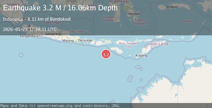
Earthquake South of Sumbawa, Indonesia
Wed, 28 Jan 2026 12:34:30 GMT
Time1 hour ago
Location
-10.2834, 118.3297
Depth
10.0 KM
Event Summary
A 3.0 magnitude earthquake struck on South of Sumbawa, Indonesia, at Wed, 28 Jan 2026 12:34:30 GMT. Depth: 10km. Reviewed by BMKG seismologists, this minor quake occurred at a magnitude type of M.
Magnitude
3.0
M
Source
BMKG
Intensity
-
Agency Reports
1 Sources| Source | Magnitude | Depth | Time |
|---|---|---|---|
| BMKGPrimary | 3.0 | 10 km | 1 hour ago |
Earthquake Details
AutomaticEvent IDbmg2026byhm
Tsunami PotentialNo
Magnitude TypeM
Nearest Places
- Tanjung Karosso98.5 km
- Tanjung Waibuku102.0 km
- Waibuku102.2 km
- Tanjung Mbulir102.4 km
- Loko Waikataku102.7 km
Comments
Join the discussion about this event.
Latest Earthquakes
0.8Mag
7 km WNW of Cobb, CA
Time1 hour ago
Depth2.06 km
SourceUSGS (Automatic)
4.1Mag
Off West Coast of Northern Sumatra
Time1 hour ago
Depth31.85 km
SourceBMKG (Automatic)
4.3Mag
MORO GULF, MINDANAO, PHILIPPINES
Time1 hour ago
Depth8.00 km
SourcePIVS (Automatic)
1.8Mag
14 km NE of Indio, CA
Time1 hour ago
Depth2.39 km
SourceUSGS (Automatic)
1.3Mag
23 km SW of Snyder, Texas
Time1 hour ago
Depth2.69 km
SourceUSGS (Automatic)
Nearby Earthquakes
3.8Mag
South of Sumbawa, Indonesia
Time7 hours ago
Depth21.53 km
SourceBMKG (Automatic)
2.7Mag
South of Sumbawa, Indonesia
Time2 days ago
Depth10.00 km
SourceBMKG (Automatic)
3.2Mag
Sumba Region, Indonesia
Time1 week ago
Depth6.75 km
SourceBMKG (Automatic)
2.8Mag
Sumbawa Region, Indonesia
Time2 days ago
Depth72.60 km
SourceBMKG (Automatic)
2.6Mag
Sumbawa Region, Indonesia
Time6 days ago
Depth13.04 km
SourceBMKG (Automatic)