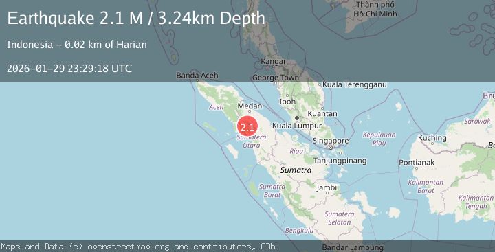
Earthquake Northern Sumatra, Indonesia
Thu, 29 Jan 2026 23:29:18 GMT
Time5 hours ago
Location
2.6436, 98.5339
Depth
3.2 KM
Event Summary
A 2.1 magnitude earthquake struck on Northern Sumatra, Indonesia, at Thu, 29 Jan 2026 23:29:18 GMT. Depth: 3.236785km. Reviewed by BMKG seismologists, this minor quake occurred at a magnitude type of M.
Magnitude
2.1
M
Source
BMKG
Intensity
-
Agency Reports
1 Sources| Source | Magnitude | Depth | Time |
|---|---|---|---|
| BMKGPrimary | 2.1 | 3 km | 5 hours ago |
Earthquake Details
AutomaticEvent IDbmg2026cayp
Tsunami PotentialNo
Magnitude TypeM
Nearest Places
- Desa Parbuluan Lima2.3 km
- Huta Korat3.3 km
- Desa Parbuluan Enam3.5 km
- Sosor Malau3.9 km
- Parbuluan5.1 km
Comments
Join the discussion about this event.
Latest Earthquakes
0.3Mag
8 km NW of The Geysers, CA
Time5 hours ago
Depth1.65 km
SourceUSGS (Automatic)
2.7Mag
South of Sumbawa, Indonesia
Time5 hours ago
Depth10.00 km
SourceBMKG (Automatic)
3.2Mag
NEAR THE COAST OF WESTERN TURKEY
Time5 hours ago
Depth7.10 km
SourceAFAD (Automatic)
0.7Mag
NORTHERN ITALY
Time5 hours ago
Depth6.00 km
SourceOGS (Automatic)
2.6Mag
ANTOFAGASTA, CHILE
Time5 hours ago
Depth66.10 km
SourceCSN (Automatic)
Nearby Earthquakes
2.5Mag
Northern Sumatra, Indonesia
Time1 week ago
Depth4.40 km
SourceBMKG (Automatic)
2.2Mag
Northern Sumatra, Indonesia
Time13 hours ago
Depth11.65 km
SourceBMKG (Automatic)
2.7Mag
Northern Sumatra, Indonesia
Time1 week ago
Depth8.59 km
SourceBMKG (Automatic)
2.1Mag
Northern Sumatra, Indonesia
Time2 days ago
Depth12.54 km
SourceBMKG (Automatic)
2.3Mag
Northern Sumatra, Indonesia
Time6 days ago
Depth15.30 km
SourceBMKG (Automatic)