Earthquake Northern Sumatra, Indonesia
Fri, 23 Jan 2026 22:52:36 GMT
Time3 days ago
Location
1.8349, 99.0712
Depth
15.3 KM
Event Summary
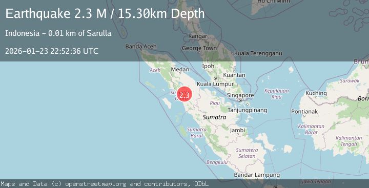
A 2.3 magnitude earthquake struck on Northern Sumatra, Indonesia, at Fri, 23 Jan 2026 22:52:36 GMT. Depth: 15.302955km. Reviewed by BMKG seismologists, this minor quake occurred at a magnitude type of M.
Magnitude
2.3
M
Source
BMKG
Intensity
-
Agency Reports
1 Sources| Source | Magnitude | Depth | Time |
|---|---|---|---|
| BMKGPrimary | 2.3 | 15 km | 3 days ago |
Earthquake Details
AutomaticEvent IDbmg2026bpyj
Tsunami PotentialNo
Magnitude TypeM
Nearest Places
- Air Lingkung Aek0.7 km
- Desa Sigurung-Gurung1.1 km
- Air Pargarutan1.2 km
- Labuunte1.3 km
- Desa Lumban Gaol1.3 km
Comments
Join the discussion about this event.
Latest Earthquakes
3.7Mag
Java, Indonesia
Time7 minutes ago
Depth26.88 km
SourceBMKG (Automatic)
1.7Mag
20 km ENE of Arvin, CA
Time8 minutes ago
Depth5.64 km
SourceUSGS (Automatic)
2.3Mag
57 km E of Pedro Bay, Alaska
Time14 minutes ago
Depth120.40 km
SourceUSGS (Automatic)
2.3Mag
Bali Sea
Time15 minutes ago
Depth13.31 km
SourceBMKG (Automatic)
1.9Mag
97 km S of Kokhanok, Alaska
Time19 minutes ago
Depth5.00 km
SourceUSGS (Automatic)
Nearby Earthquakes
2.4Mag
Northern Sumatra, Indonesia
Time5 days ago
Depth2.17 km
SourceBMKG (Automatic)
3.2Mag
Northern Sumatra, Indonesia
Time4 days ago
Depth8.24 km
SourceBMKG (Automatic)
2.7Mag
Northern Sumatra, Indonesia
Time6 days ago
Depth8.59 km
SourceBMKG (Automatic)
2.5Mag
Northern Sumatra, Indonesia
Time5 days ago
Depth4.40 km
SourceBMKG (Automatic)
2.1Mag
Northern Sumatra, Indonesia
Time1 hour ago
Depth12.54 km
SourceBMKG (Automatic)