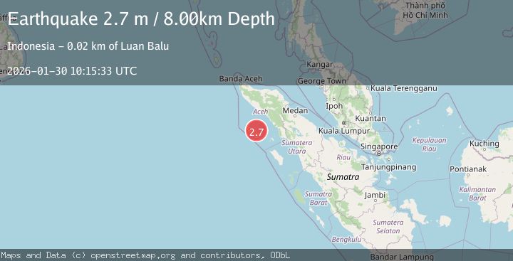
Earthquake Northern Sumatra, Indonesia
Fri, 30 Jan 2026 10:15:33 GMT
Time1 hour ago
Location
2.6893, 96.3211
Depth
8.3 KM
Event Summary
A 2.7 magnitude earthquake struck on Northern Sumatra, Indonesia, at Fri, 30 Jan 2026 10:15:33 GMT. Depth: 8.30961km. Reviewed by BMKG seismologists, this minor quake occurred at a magnitude type of M.
Magnitude
2.7
M
Source
BMKG
Intensity
-
Agency Reports
1 Sources| Source | Magnitude | Depth | Time |
|---|---|---|---|
| BMKGPrimary | 2.7 | 8 km | 1 hour ago |
Earthquake Details
AutomaticEvent IDbmg2026cbtx
Tsunami PotentialNo
Magnitude TypeM
Nearest Places
- Karang Dog3.0 km
- Limau4.6 km
- Gampong Pulau Siumat7.3 km
- Pulau Siumat7.5 km
- Mantahari9.0 km
Comments
Join the discussion about this event.
Latest Earthquakes
2.3Mag
ISLAND OF HAWAII, HAWAII
Time1 hour ago
Depth30.40 km
SourceHV (Automatic)
2.2Mag
SWITZERLAND
Time1 hour ago
Depth10.90 km
SourceETHZ (Automatic)
2.1Mag
FRANCE
Time1 hour ago
Depth5.00 km
SourceReNaSS (Automatic)
3.0Mag
Java, Indonesia
Time1 hour ago
Depth10.00 km
SourceBMKG (Automatic)
2.9Mag
GREECE
Time1 hour ago
Depth25.60 km
SourceNOA (Automatic)
Nearby Earthquakes
4.4Mag
Northern Sumatra, Indonesia
Time21 hours ago
Depth10.00 km
SourceBMKG (Automatic)
2.5Mag
Northern Sumatra, Indonesia
Time5 days ago
Depth10.00 km
SourceBMKG (Automatic)
2.3Mag
Northern Sumatra, Indonesia
Time23 hours ago
Depth6.40 km
SourceBMKG (Automatic)
2.3Mag
Northern Sumatra, Indonesia
Time1 week ago
Depth49.78 km
SourceBMKG (Automatic)
2.9Mag
Northern Sumatra, Indonesia
Time5 days ago
Depth30.75 km
SourceBMKG (Automatic)