Earthquake Southern Sumatra, Indonesia
Fri, 30 Jan 2026 22:09:53 GMT
Time1 hour ago
Location
-5.2511, 103.8517
Depth
100.1 KM
Event Summary
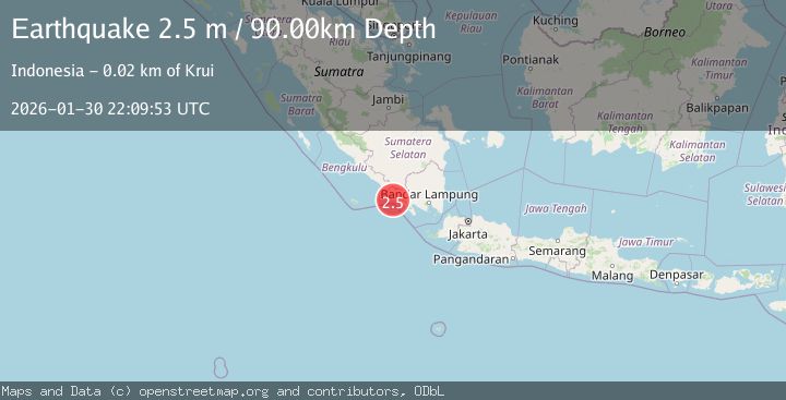
A 2.4 magnitude earthquake struck on Southern Sumatra, Indonesia, at Fri, 30 Jan 2026 22:09:53 GMT. Depth: 100.121666km. Reviewed by BMKG seismologists, this minor quake occurred at a magnitude type of M.
Magnitude
2.4
M
Source
BMKG
Intensity
-
Agency Reports
1 Sources| Source | Magnitude | Depth | Time |
|---|---|---|---|
| BMKGPrimary | 2.4 | 100 km | 1 hour ago |
Earthquake Details
AutomaticEvent IDbmg2026ccrm
Tsunami PotentialNo
Magnitude TypeM
Nearest Places
- Ujung Walor6.8 km
- Desa Walur7.3 km
- Walur7.5 km
- Desa Suka Jadi7.6 km
- Padangnegeri7.8 km
Comments
Join the discussion about this event.
Latest Earthquakes
2.7Mag
Flores Region, Indonesia
Time1 hour ago
Depth10.00 km
SourceBMKG (Automatic)
1.2Mag
3 km S of Cobb, CA
Time1 hour ago
Depth1.49 km
SourceUSGS (Automatic)
3.3Mag
14 km SE of Elmendorf Air Force Base, Alaska
Time1 hour ago
Depth27.20 km
SourceUSGS (Automatic)
3.7Mag
PHILIPPINE ISLANDS REGION
Time1 hour ago
Depth10.00 km
SourcePIVS (Automatic)
1.2Mag
WESTERN TURKEY
Time1 hour ago
Depth11.60 km
SourceAFAD (Automatic)
Nearby Earthquakes
2.7Mag
Southern Sumatra, Indonesia
Time6 days ago
Depth27.97 km
SourceBMKG (Automatic)
2.6Mag
Southern Sumatra, Indonesia
Time22 hours ago
Depth18.59 km
SourceBMKG (Automatic)
2.9Mag
Southern Sumatra, Indonesia
Time4 days ago
Depth22.12 km
SourceBMKG (Automatic)
2.5Mag
Southern Sumatra, Indonesia
Time3 days ago
Depth10.48 km
SourceBMKG (Automatic)
2.0Mag
Southern Sumatra, Indonesia
Time1 day ago
Depth10.00 km
SourceBMKG (Automatic)