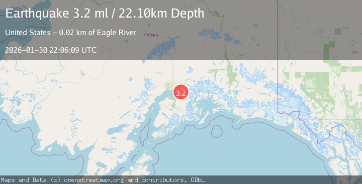
Earthquake 14 km SE of Elmendorf Air Force Base, Alaska
Fri, 30 Jan 2026 22:06:08 GMT
Time7 hours ago
Location
61.1840, -149.4120
Depth
27.2 KM
Event Summary
A 3.3 magnitude earthquake struck on 14 km SE of Elmendorf Air Force Base, Alaska, at Fri, 30 Jan 2026 22:06:08 GMT. Depth: 27.2km. Reviewed by USGS seismologists, this minor quake occurred at a magnitude type of ml.
Magnitude
3.3
ml
Source
USGS
Intensity
-
Agency Reports
2 Sources| Source | Magnitude | Depth | Time |
|---|---|---|---|
| USGSPrimary | 3.3 | 27 km | 7 hours ago |
| AK | 3.3 | 27 km | 7 hours ago |
Earthquake Details
AutomaticEvent IDusgs_ak2026ccyahi
Tsunami PotentialNo
Magnitude Typeml
Nearest Places
- Symphony Lake2.1 km
- Eagle Lake2.5 km
- Harp Mountain4.5 km
- Chugach State Park4.6 km
- South Fork Volunteer Fire Department4.7 km
Comments
Join the discussion about this event.
Latest Earthquakes
3.7Mag
PHILIPPINE ISLANDS REGION
Time7 hours ago
Depth10.00 km
SourcePIVS (Automatic)
2.2Mag
Sumbawa Region, Indonesia
Time7 hours ago
Depth26.29 km
SourceBMKG (Automatic)
0.6Mag
21 km ENE of Little Lake, CA
Time7 hours ago
Depth2.37 km
SourceUSGS (Automatic)
4.3Mag
CENTRAL ALASKA
Time7 hours ago
Depth85.90 km
SourceAK (Automatic)
1.5Mag
3 km NNW of Palomar Observatory, CA
Time7 hours ago
Depth8.74 km
SourceUSGS (Automatic)
Nearby Earthquakes
2.5Mag
5 km SE of Elmendorf Air Force Base, Alaska
Time1 week ago
Depth39.60 km
SourceUSGS (Automatic)
1.3Mag
7 km NW of Girdwood, Alaska
Time6 days ago
Depth34.60 km
SourceUSGS (Automatic)
1.1Mag
9 km NE of Girdwood, Alaska
Time6 days ago
Depth31.40 km
SourceUSGS (Automatic)
1.8Mag
17 km NE of Girdwood, Alaska
Time1 day ago
Depth5.00 km
SourceUSGS (Automatic)
2.6Mag
6 km SSW of Girdwood, Alaska
Time5 days ago
Depth24.40 km
SourceUSGS (Automatic)