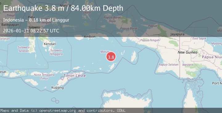
Earthquake Tanimbar Islands Region, Indonesia
Sat, 31 Jan 2026 08:22:57 GMT
Time1 hour ago
Location
-6.1523, 131.2257
Depth
84.5 KM
Event Summary
A 3.8 magnitude earthquake struck on Tanimbar Islands Region, Indonesia, at Sat, 31 Jan 2026 08:22:57 GMT. Depth: 84.48394km. Reviewed by BMKG seismologists, this minor quake occurred at a magnitude type of M.
Magnitude
3.8
M
Source
BMKG
Intensity
-
Agency Reports
1 Sources| Source | Magnitude | Depth | Time |
|---|---|---|---|
| BMKGPrimary | 3.8 | 84 km | 1 hour ago |
Earthquake Details
AutomaticEvent IDbmg2026cdlr
Tsunami PotentialNo
Magnitude TypeM
Nearest Places
- Weber Basin30.2 km
- Pulau Kalbur69.2 km
- Nuhututul69.4 km
- Melwuarniweyar70.7 km
- Desa Adodo Molu70.9 km
Comments
Join the discussion about this event.
Latest Earthquakes
2.9Mag
Timor Region
Time1 hour ago
Depth21.53 km
SourceBMKG (Automatic)
1.3Mag
NORTHERN ITALY
Time1 hour ago
Depth2.70 km
SourceETHZ (Automatic)
1.7Mag
61 km NW of Skwentna, Alaska
Time2 hours ago
Depth0.50 km
SourceUSGS (Automatic)
1.8Mag
34 km SSE of Volcano, Hawaii
Time2 hours ago
Depth37.73 km
SourceUSGS (Automatic)
2.5Mag
Sumbawa Region, Indonesia
Time2 hours ago
Depth108.99 km
SourceBMKG (Automatic)
Nearby Earthquakes
3.4Mag
Banda Sea
Time3 days ago
Depth159.46 km
SourceBMKG (Automatic)
5.5Mag
Banda Sea
Time6 days ago
Depth155.21 km
SourceBMKG (Automatic)
3.8Mag
Banda Sea
Time5 days ago
Depth164.97 km
SourceBMKG (Automatic)
3.9Mag
Banda Sea
Time3 days ago
Depth247.75 km
SourceBMKG (Automatic)
4.1Mag
Banda Sea
Time1 week ago
Depth170.70 km
SourceBMKG (Automatic)