Earthquake 61 km NW of Skwentna, Alaska
Sat, 31 Jan 2026 08:08:48 GMT
Time1 hour ago
Location
62.4200, -152.1510
Depth
0.5 KM
Event Summary
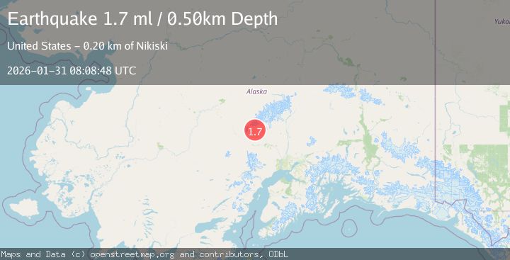
A 1.7 magnitude earthquake struck on 61 km NW of Skwentna, Alaska, at Sat, 31 Jan 2026 08:08:48 GMT. Depth: 0.5km. Reviewed by USGS seismologists, this minor quake occurred at a magnitude type of ml.
Magnitude
1.7
ml
Source
USGS
Intensity
-
Agency Reports
1 Sources| Source | Magnitude | Depth | Time |
|---|---|---|---|
| USGSPrimary | 1.7 | 1 km | 1 hour ago |
Earthquake Details
AutomaticEvent IDusgs_ak2026cdrzpz
Tsunami PotentialNo
Magnitude Typeml
Nearest Places
- Cascade Creek9.2 km
- Denali National Preserve10.2 km
- Midway Lakes13.0 km
- Fourth of July Creek18.3 km
- Mount Dall19.2 km
Comments
Join the discussion about this event.
Latest Earthquakes
0.2Mag
6 km WNW of Cobb, CA
Time3 minutes ago
Depth1.50 km
SourceUSGS (Automatic)
2.5Mag
Northern Sumatra, Indonesia
Time8 minutes ago
Depth7.53 km
SourceBMKG (Automatic)
2.1Mag
WESTERN MEDITERRANEAN SEA
Time24 minutes ago
Depth8.70 km
SourceIGN (Automatic)
2.9Mag
South of Sumbawa, Indonesia
Time28 minutes ago
Depth23.49 km
SourceBMKG (Automatic)
1.9Mag
6 km SSW of Independence, CA
Time40 minutes ago
Depth6.34 km
SourceUSGS (Automatic)
Nearby Earthquakes
2.5Mag
70 km W of Petersville, Alaska
Time2 days ago
Depth4.00 km
SourceUSGS (Automatic)
1.0Mag
24 km W of Petersville, Alaska
Time5 days ago
Depth82.10 km
SourceUSGS (Automatic)
3.0Mag
CENTRAL ALASKA
Time3 hours ago
Depth88.60 km
SourceAK (Automatic)
2.3Mag
23 km W of Petersville, Alaska
Time6 days ago
Depth88.80 km
SourceUSGS (Automatic)
2.2Mag
22 km W of Petersville, Alaska
Time1 day ago
Depth84.60 km
SourceUSGS (Automatic)