Earthquake Bali Region, Indonesia
Sun, 01 Feb 2026 14:44:03 GMT
Time4 days ago
Location
-8.2973, 115.6738
Depth
20.8 KM
Event Summary
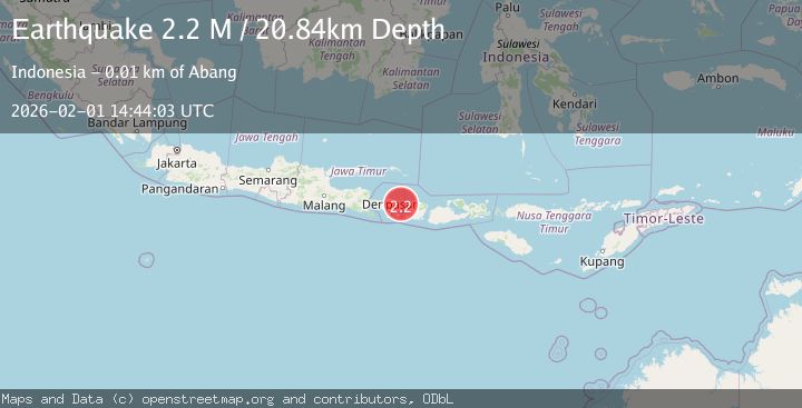
A 2.2 magnitude earthquake struck on Bali Region, Indonesia, at Sun, 01 Feb 2026 14:44:03 GMT. Depth: 20.836338km. Reviewed by BMKG seismologists, this minor quake occurred at a magnitude type of M.
Magnitude
2.2
M
Source
BMKG
Intensity
-
Agency Reports
1 Sources| Source | Magnitude | Depth | Time |
|---|---|---|---|
| BMKGPrimary | 2.2 | 21 km | 4 days ago |
Earthquake Details
AutomaticEvent IDbmg2026cftt
Tsunami PotentialNo
Magnitude TypeM
Nearest Places
- Kabupaten Karangasem4.1 km
- Teluk Jemeluk4.7 km
- Labuan Ambat4.8 km
- Ambat4.8 km
- Tukad Jemeluk4.8 km
Comments
Join the discussion about this event.
Latest Earthquakes
1.2Mag
10 km SSW of Idyllwild, CA
Time7 minutes ago
Depth12.04 km
SourceUSGS (Automatic)
2.3Mag
16 km NE of Susitna, Alaska
Time10 minutes ago
Depth22.60 km
SourceUSGS (Automatic)
4.3Mag
Southern Sumatra, Indonesia
Time13 minutes ago
Depth10.00 km
SourceBMKG (Automatic)
3.7Mag
CRETE, GREECE
Time14 minutes ago
Depth10.00 km
SourceTHE (Automatic)
2.4Mag
CENTRAL CALIFORNIA
Time21 minutes ago
Depth4.00 km
SourceNC (Automatic)
Nearby Earthquakes
3.5Mag
Bali Region, Indonesia
Time4 days ago
Depth8.96 km
SourceBMKG (Automatic)
2.4Mag
Bali Region, Indonesia
Time1 week ago
Depth110.29 km
SourceBMKG (Automatic)
2.1Mag
Sumbawa Region, Indonesia
Time1 week ago
Depth17.97 km
SourceBMKG (Automatic)
2.2Mag
Bali Sea
Time5 days ago
Depth13.62 km
SourceBMKG (Automatic)
2.2Mag
Bali Region, Indonesia
Time1 week ago
Depth84.98 km
SourceBMKG (Automatic)