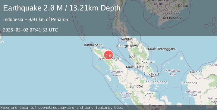
Earthquake Northern Sumatra, Indonesia
Mon, 02 Feb 2026 07:41:33 GMT
Time14 hours ago
Location
4.4042, 97.5923
Depth
13.2 KM
Event Summary
A 2.0 magnitude earthquake struck on Northern Sumatra, Indonesia, at Mon, 02 Feb 2026 07:41:33 GMT. Depth: 13.206569km. Reviewed by BMKG seismologists, this minor quake occurred at a magnitude type of M.
Magnitude
2.0
M
Source
BMKG
Intensity
-
Agency Reports
1 Sources| Source | Magnitude | Depth | Time |
|---|---|---|---|
| BMKGPrimary | 2.0 | 13 km | 14 hours ago |
Earthquake Details
AutomaticEvent IDbmg2026chbi
Tsunami PotentialNo
Magnitude TypeM
Nearest Places
- Alur Canang2.2 km
- Alur Kemenyan3.1 km
- Gampong Sunti3.9 km
- Gampong Umah Taring4.0 km
- Gampong Ujung Karang4.2 km
Comments
Join the discussion about this event.
Latest Earthquakes
1.0Mag
6 km ESE of Big Bear City, CA
Time14 hours ago
Depth1.75 km
SourceUSGS (Automatic)
1.4Mag
22 km WNW of Garden City, Texas
Time14 hours ago
Depth3.39 km
SourceUSGS (Automatic)
2.2Mag
NORTHERN ITALY
Time14 hours ago
Depth4.50 km
SourceINGV (Automatic)
2.0Mag
Java, Indonesia
Time14 hours ago
Depth15.39 km
SourceBMKG (Automatic)
1.8Mag
44 km NW of Tatitlek, Alaska
Time14 hours ago
Depth2.60 km
SourceUSGS (Automatic)
Nearby Earthquakes
2.4Mag
Northern Sumatra, Indonesia
Time1 week ago
Depth6.95 km
SourceBMKG (Automatic)
2.4Mag
Northern Sumatra, Indonesia
Time6 days ago
Depth1.40 km
SourceBMKG (Automatic)
2.2Mag
Northern Sumatra, Indonesia
Time1 week ago
Depth1.65 km
SourceBMKG (Automatic)
2.9Mag
Northern Sumatra, Indonesia
Time2 days ago
Depth5.00 km
SourceBMKG (Automatic)
2.2Mag
Northern Sumatra, Indonesia
Time3 days ago
Depth10.00 km
SourceBMKG (Automatic)