Earthquake West Papua Region, Indonesia
Tue, 03 Feb 2026 17:51:17 GMT
Time23 hours ago
Location
-0.5426, 130.0007
Depth
5.0 KM
Event Summary
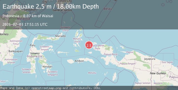
A 2.4 magnitude earthquake struck on West Papua Region, Indonesia, at Tue, 03 Feb 2026 17:51:17 GMT. Depth: 5.015124km. Reviewed by BMKG seismologists, this minor quake occurred at a magnitude type of M.
Magnitude
2.4
M
Source
BMKG
Intensity
-
Agency Reports
1 Sources| Source | Magnitude | Depth | Time |
|---|---|---|---|
| BMKGPrimary | 2.4 | 5 km | 23 hours ago |
Earthquake Details
AutomaticEvent IDbmg2026cjqy
Tsunami PotentialNo
Magnitude TypeM
Nearest Places
- Gosong Nelayan7.9 km
- Majet14.1 km
- Tanjung Pauapu16.4 km
- Distrik Waigeo Barat Kepulauan17.1 km
- Pulau Gag17.3 km
Comments
Join the discussion about this event.
Latest Earthquakes
2.0Mag
Flores Region, Indonesia
Time23 hours ago
Depth10.00 km
SourceBMKG (Automatic)
2.8Mag
SOUTH OF JAVA, INDONESIA
Time23 hours ago
Depth29.00 km
SourceBMKG (Automatic)
2.1Mag
25 km WSW of Petersville, Alaska
Time23 hours ago
Depth76.70 km
SourceUSGS (Automatic)
1.6Mag
3 km NNW of Redway, CA
Time23 hours ago
Depth20.38 km
SourceUSGS (Automatic)
4.0Mag
CENTRAL PERU
Time23 hours ago
Depth130.00 km
SourceLIM (Automatic)
Nearby Earthquakes
2.8Mag
Halmahera, Indonesia
Time1 week ago
Depth20.95 km
SourceBMKG (Automatic)
2.2Mag
West Papua Region, Indonesia
Time2 days ago
Depth12.11 km
SourceBMKG (Automatic)
2.7Mag
Halmahera, Indonesia
Time3 days ago
Depth10.00 km
SourceBMKG (Automatic)
2.5Mag
West Papua Region, Indonesia
Time2 days ago
Depth9.00 km
SourceBMKG (Automatic)
2.2Mag
Halmahera, Indonesia
Time1 week ago
Depth12.67 km
SourceBMKG (Automatic)