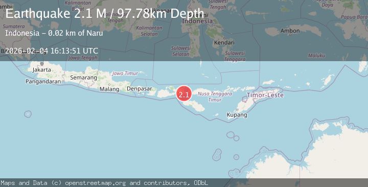
Earthquake Flores Region, Indonesia
Wed, 04 Feb 2026 16:13:51 GMT
Time1 hour ago
Location
-8.7405, 119.0912
Depth
97.8 KM
Event Summary
A 2.1 magnitude earthquake struck on Flores Region, Indonesia, at Wed, 04 Feb 2026 16:13:51 GMT. Depth: 97.782616km. Reviewed by BMKG seismologists, this minor quake occurred at a magnitude type of M.
Magnitude
2.1
M
Source
BMKG
Intensity
-
Agency Reports
1 Sources| Source | Magnitude | Depth | Time |
|---|---|---|---|
| BMKGPrimary | 2.1 | 98 km | 1 hour ago |
Earthquake Details
AutomaticEvent IDbmg2026cljg
Tsunami PotentialNo
Magnitude TypeM
Nearest Places
- Nggelu2.8 km
- Tano Nggelu3.0 km
- Doro Rata4.0 km
- Desa Nggelu4.5 km
- Toro Rata4.7 km
Comments
Join the discussion about this event.
Latest Earthquakes
2.1Mag
12 km NW of Fishhook, Alaska
Time1 hour ago
Depth22.90 km
SourceUSGS (Automatic)
2.9Mag
Bali Sea
Time2 hours ago
Depth16.06 km
SourceBMKG (Automatic)
2.7Mag
West Papua Region, Indonesia
Time2 hours ago
Depth10.00 km
SourceBMKG (Automatic)
3.2Mag
CRETE, GREECE
Time2 hours ago
Depth10.00 km
SourceTHE (Automatic)
2.5Mag
STRAIT OF GIBRALTAR
Time2 hours ago
Depth21.30 km
SourceEMSC (Automatic)
Nearby Earthquakes
2.8Mag
Flores Region, Indonesia
Time4 hours ago
Depth96.66 km
SourceBMKG (Automatic)
2.6Mag
Flores Region, Indonesia
Time1 week ago
Depth134.98 km
SourceBMKG (Automatic)
2.1Mag
Flores Region, Indonesia
Time1 week ago
Depth114.68 km
SourceBMKG (Automatic)
2.0Mag
Sumbawa Region, Indonesia
Time1 week ago
Depth107.77 km
SourceBMKG (Automatic)
2.4Mag
Flores Region, Indonesia
Time2 weeks ago
Depth10.00 km
SourceBMKG (Automatic)