Earthquake West Papua, Indonesia
Fri, 06 Feb 2026 10:24:07 GMT
Time1 hour ago
Location
-3.7679, 136.6989
Depth
115.5 KM
Event Summary
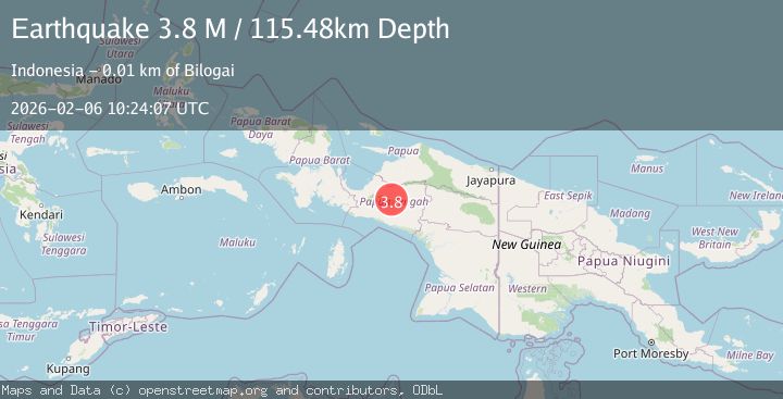
A 3.8 magnitude earthquake struck on West Papua, Indonesia, at Fri, 06 Feb 2026 10:24:07 GMT. Depth: 115.480217km. Reviewed by BMKG seismologists, this minor quake occurred at a magnitude type of M.
Magnitude
3.8
M
Source
BMKG
Intensity
-
Agency Reports
1 Sources| Source | Magnitude | Depth | Time |
|---|---|---|---|
| BMKGPrimary | 3.8 | 115 km | 1 hour ago |
Earthquake Details
AutomaticEvent IDbmg2026coos
Tsunami PotentialNo
Magnitude TypeM
Nearest Places
- Kampung Mbugulo3.0 km
- Kampung Jae5.1 km
- Kampung Bonogo5.5 km
- Bilogai6.5 km
- Distrik Wandai7.6 km
Comments
Join the discussion about this event.
Latest Earthquakes
2.8Mag
Java, Indonesia
Time3 minutes ago
Depth29.73 km
SourceBMKG (Automatic)
1.5Mag
3 km NW of The Geysers, CA
Time10 minutes ago
Depth3.65 km
SourceUSGS (Automatic)
3.0Mag
ANTOFAGASTA, CHILE
Time18 minutes ago
Depth121.70 km
SourceCSN (Automatic)
2.1Mag
Sulawesi, Indonesia
Time21 minutes ago
Depth6.76 km
SourceBMKG (Automatic)
3.0Mag
ARUNACHAL PRADESH, INDIA
Time23 minutes ago
Depth14.00 km
SourceNDI (Automatic)
Nearby Earthquakes
4.2Mag
West Papua, Indonesia
Time1 week ago
Depth12.25 km
SourceBMKG (Automatic)
3.5Mag
West Papua, Indonesia
Time5 days ago
Depth10.00 km
SourceBMKG (Automatic)
3.0Mag
PAPUA, INDONESIA
Time1 week ago
Depth10.00 km
SourceBMKG (Automatic)
2.9Mag
West Papua, Indonesia
Time3 days ago
Depth10.00 km
SourceBMKG (Automatic)
2.5Mag
PAPUA, INDONESIA
Time1 week ago
Depth10.00 km
SourceBMKG (Automatic)