Earthquake West Papua, Indonesia
Mon, 02 Feb 2026 17:39:35 GMT
Time4 hours ago
Location
-3.3337, 136.0109
Depth
10.0 KM
Event Summary
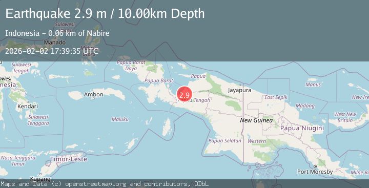
A 2.9 magnitude earthquake struck on West Papua, Indonesia, at Mon, 02 Feb 2026 17:39:35 GMT. Depth: 10km. Reviewed by BMKG seismologists, this minor quake occurred at a magnitude type of M.
Magnitude
2.9
M
Source
BMKG
Intensity
-
Agency Reports
1 Sources| Source | Magnitude | Depth | Time |
|---|---|---|---|
| BMKGPrimary | 2.9 | 10 km | 4 hours ago |
Earthquake Details
AutomaticEvent IDbmg2026chvb
Tsunami PotentialNo
Magnitude TypeM
Nearest Places
- Kurare7.5 km
- Tatawa10.6 km
- Boremah11.2 km
- Kampung Epomani12.2 km
- Nehe12.7 km
Comments
Join the discussion about this event.
Latest Earthquakes
1.7Mag
8 km ESE of Atascadero, CA
Time4 hours ago
Depth4.59 km
SourceUSGS (Automatic)
2.2Mag
Sumba Region, Indonesia
Time4 hours ago
Depth10.00 km
SourceBMKG (Automatic)
2.3Mag
Northern Sumatra, Indonesia
Time4 hours ago
Depth137.51 km
SourceBMKG (Automatic)
2.5Mag
PUERTO RICO REGION
Time4 hours ago
Depth16.10 km
SourceNEIC (Automatic)
2.7Mag
SOUTHERN ITALY
Time4 hours ago
Depth9.80 km
SourceINGV (Automatic)
Nearby Earthquakes
3.5Mag
West Papua Region, Indonesia
Time3 days ago
Depth44.97 km
SourceBMKG (Automatic)
2.6Mag
West Papua Region, Indonesia
Time5 hours ago
Depth10.00 km
SourceBMKG (Automatic)
3.0Mag
PAPUA, INDONESIA
Time1 week ago
Depth10.00 km
SourceBMKG (Automatic)
4.2Mag
West Papua, Indonesia
Time3 days ago
Depth12.25 km
SourceBMKG (Automatic)
3.6Mag
West Papua Region, Indonesia
Time1 week ago
Depth10.00 km
SourceBMKG (Automatic)