Earthquake Sumbawa Region, Indonesia
Fri, 06 Feb 2026 19:53:43 GMT
Time1 hour ago
Location
-8.3609, 117.9430
Depth
121.9 KM
Event Summary
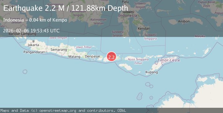
A 2.2 magnitude earthquake struck on Sumbawa Region, Indonesia, at Fri, 06 Feb 2026 19:53:43 GMT. Depth: 121.878769km. Reviewed by BMKG seismologists, this minor quake occurred at a magnitude type of M.
Magnitude
2.2
M
Source
BMKG
Intensity
-
Agency Reports
1 Sources| Source | Magnitude | Depth | Time |
|---|---|---|---|
| BMKGPrimary | 2.2 | 122 km | 1 hour ago |
Earthquake Details
AutomaticEvent IDbmg2026cphm
Tsunami PotentialNo
Magnitude TypeM
Nearest Places
- Desa Sori Tatanga6.3 km
- Doro Mboha6.8 km
- Tanjung Mboha7.0 km
- Balinanakardia8.5 km
- Sori Mange9.7 km
Comments
Join the discussion about this event.
Latest Earthquakes
1.7Mag
5 km SE of Mineral, Washington
Time4 minutes ago
Depth20.67 km
SourceUSGS (Automatic)
2.1Mag
WESTERN TURKEY
Time6 minutes ago
Depth7.60 km
SourceKOERI (Automatic)
1.2Mag
3 km SE of Loma Linda, CA
Time11 minutes ago
Depth3.54 km
SourceUSGS (Automatic)
1.2Mag
24 km NNW of Westbrook, Texas
Time13 minutes ago
Depth4.04 km
SourceUSGS (Automatic)
2.3Mag
62 km SE of Pope-Vannoy Landing, Alaska
Time19 minutes ago
Depth104.10 km
SourceUSGS (Automatic)
Nearby Earthquakes
2.4Mag
Sumbawa Region, Indonesia
Time2 weeks ago
Depth18.56 km
SourceBMKG (Automatic)
2.1Mag
Sumbawa Region, Indonesia
Time1 week ago
Depth52.07 km
SourceBMKG (Automatic)
2.2Mag
Sumbawa Region, Indonesia
Time5 days ago
Depth115.60 km
SourceBMKG (Automatic)
3.3Mag
Sumbawa Region, Indonesia
Time1 week ago
Depth14.04 km
SourceBMKG (Automatic)
2.5Mag
Sumbawa Region, Indonesia
Time2 weeks ago
Depth27.17 km
SourceBMKG (Automatic)