Earthquake Sumba Region, Indonesia
Sat, 07 Feb 2026 17:04:38 GMT
Time1 day ago
Location
-10.3889, 120.4317
Depth
24.1 KM
Event Summary
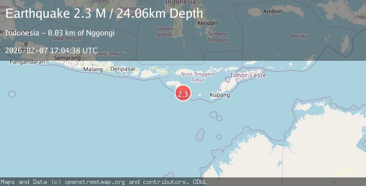
A 2.3 magnitude earthquake struck on Sumba Region, Indonesia, at Sat, 07 Feb 2026 17:04:38 GMT. Depth: 24.058693km. Reviewed by BMKG seismologists, this minor quake occurred at a magnitude type of M.
Magnitude
2.3
M
Source
BMKG
Intensity
-
Agency Reports
1 Sources| Source | Magnitude | Depth | Time |
|---|---|---|---|
| BMKGPrimary | 2.3 | 24 km | 1 day ago |
Earthquake Details
AutomaticEvent IDbmg2026cqxk
Tsunami PotentialNo
Magnitude TypeM
Nearest Places
- Tanjung Ngunju9.2 km
- Desa Hambawutang15.1 km
- Tandula Pangaduhaha15.9 km
- Ngaruwinu Atas15.9 km
- Kanimbu16.1 km
Comments
Join the discussion about this event.
Latest Earthquakes
2.6Mag
Flores Sea
Time2 minutes ago
Depth20.23 km
SourceBMKG (Automatic)
3.6Mag
8 km WNW of Cobb, CA
Time3 minutes ago
Depth1.54 km
SourceUSGS (Automatic)
1.3Mag
102 km ESE of McCarthy, Alaska
Time5 minutes ago
Depth77.10 km
SourceUSGS (Automatic)
4.1Mag
Talaud Islands, Indonesia
Time5 minutes ago
Depth65.67 km
SourceBMKG (Automatic)
1.6Mag
11 km SE of Pinnacles, CA
Time5 minutes ago
Depth6.42 km
SourceUSGS (Automatic)
Nearby Earthquakes
2.4Mag
Sumba Region, Indonesia
Time1 day ago
Depth49.39 km
SourceBMKG (Automatic)
2.8Mag
Sumba Region, Indonesia
Time2 weeks ago
Depth25.99 km
SourceBMKG (Automatic)
2.7Mag
Sumba Region, Indonesia
Time2 weeks ago
Depth14.72 km
SourceBMKG (Automatic)
4.3Mag
Sumba Region, Indonesia
Time2 weeks ago
Depth6.90 km
SourceBMKG (Automatic)
2.9Mag
Sumba Region, Indonesia
Time2 weeks ago
Depth23.93 km
SourceBMKG (Automatic)