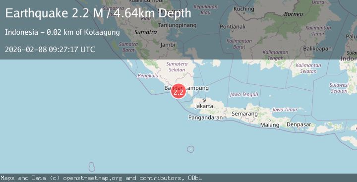
Earthquake Southern Sumatra, Indonesia
Sun, 08 Feb 2026 09:27:17 GMT
Time1 hour ago
Location
-5.3614, 104.5554
Depth
4.6 KM
Event Summary
A 2.2 magnitude earthquake struck on Southern Sumatra, Indonesia, at Sun, 08 Feb 2026 09:27:17 GMT. Depth: 4.639703km. Reviewed by BMKG seismologists, this minor quake occurred at a magnitude type of M.
Magnitude
2.2
M
Source
BMKG
Intensity
-
Agency Reports
1 Sources| Source | Magnitude | Depth | Time |
|---|---|---|---|
| BMKGPrimary | 2.2 | 5 km | 1 hour ago |
Earthquake Details
AutomaticEvent IDbmg2026csdv
Tsunami PotentialNo
Magnitude TypeM
Nearest Places
- Desa Karang Rejo1.4 km
- Kampungdelung1.6 km
- Gunung Kukusan1.7 km
- Karangtempel1.9 km
- Kampungbaru2.6 km
Comments
Join the discussion about this event.
Latest Earthquakes
2.5Mag
WESTERN XIZANG
Time12 minutes ago
Depth10.00 km
SourceNDI (Automatic)
2.6Mag
Java, Indonesia
Time15 minutes ago
Depth65.41 km
SourceBMKG (Automatic)
0.3Mag
4 km NW of The Geysers, CA
Time20 minutes ago
Depth3.29 km
SourceUSGS (Automatic)
3.7Mag
MYANMAR
Time34 minutes ago
Depth10.00 km
SourceTSB (Automatic)
1.1Mag
TURKEY-SYRIA BORDER REGION
Time35 minutes ago
Depth7.00 km
SourceAFAD (Automatic)
Nearby Earthquakes
2.1Mag
Southern Sumatra, Indonesia
Time5 days ago
Depth5.00 km
SourceBMKG (Automatic)
2.3Mag
Southern Sumatra, Indonesia
Time3 days ago
Depth15.95 km
SourceBMKG (Automatic)
2.0Mag
Southern Sumatra, Indonesia
Time1 week ago
Depth10.00 km
SourceBMKG (Automatic)
3.8Mag
Southern Sumatra, Indonesia
Time5 days ago
Depth10.00 km
SourceBMKG (Automatic)
2.1Mag
Southern Sumatra, Indonesia
Time5 days ago
Depth15.65 km
SourceBMKG (Automatic)