Earthquake Bali Sea
Mon, 09 Feb 2026 08:20:34 GMT
Time1 hour ago
Location
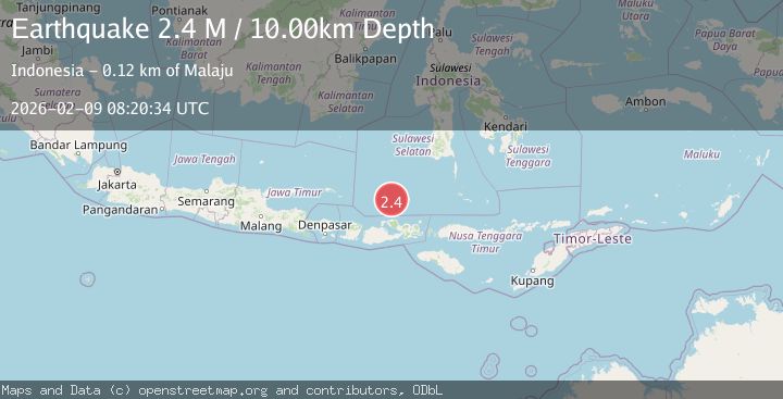
-7.2881, 117.9246
Depth
10.0 KM
Event Summary
A 2.4 magnitude earthquake struck on Bali Sea, at Mon, 09 Feb 2026 08:20:34 GMT. Depth: 10km. Reviewed by BMKG seismologists, this minor quake occurred at a magnitude type of M.
Magnitude
2.4
M
Source
BMKG
Intensity
-
Agency Reports
1 Sources| Source | Magnitude | Depth | Time |
|---|---|---|---|
| BMKGPrimary | 2.4 | 10 km | 1 hour ago |
Earthquake Details
AutomaticEvent IDbmg2026ctxd
Tsunami PotentialNo
Magnitude TypeM
Nearest Places
- Pulau Tokohbatu12.1 km
- Desa Tampaang17.8 km
- Pulau Aloang17.9 km
- Pulau Sapinggang19.2 km
- Pulau Lamuruang20.5 km
Comments
Join the discussion about this event.
Latest Earthquakes
3.9Mag
OFF COAST OF ATACAMA, CHILE
Time1 hour ago
Depth30.00 km
SourceCSN (Automatic)
2.7Mag
Timor Region
Time1 hour ago
Depth66.97 km
SourceBMKG (Automatic)
4.3Mag
PANAMA
Time2 hours ago
Depth10.00 km
SourceIGC (Automatic)
2.1Mag
NEAR SOUTH COAST OF FRANCE
Time2 hours ago
Depth5.00 km
SourceReNaSS (Automatic)
1.4Mag
43 km W of Tyonek, Alaska
Time2 hours ago
Depth85.10 km
SourceUSGS (Automatic)
Nearby Earthquakes
2.6Mag
Bali Sea
Time2 weeks ago
Depth10.00 km
SourceBMKG (Automatic)
2.5Mag
Bali Sea
Time1 week ago
Depth10.00 km
SourceBMKG (Automatic)
2.5Mag
Flores Sea
Time1 week ago
Depth12.81 km
SourceBMKG (Automatic)
4.4Mag
Bali Sea
Time4 days ago
Depth10.00 km
SourceBMKG (Automatic)
2.3Mag
Bali Sea
Time4 days ago
Depth10.00 km
SourceBMKG (Automatic)