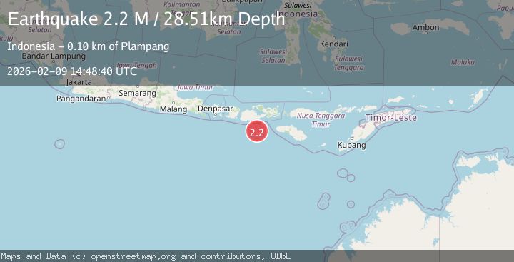
Earthquake Sumbawa Region, Indonesia
Mon, 09 Feb 2026 14:48:40 GMT
Time1 hour ago
Location
-9.6747, 117.7653
Depth
27.2 KM
Event Summary
A 2.2 magnitude earthquake struck on Sumbawa Region, Indonesia, at Mon, 09 Feb 2026 14:48:40 GMT. Depth: 27.188406km. Reviewed by BMKG seismologists, this minor quake occurred at a magnitude type of M.
Magnitude
2.2
M
Source
BMKG
Intensity
-
Agency Reports
1 Sources| Source | Magnitude | Depth | Time |
|---|---|---|---|
| BMKGPrimary | 2.2 | 27 km | 1 hour ago |
Earthquake Details
AutomaticEvent IDbmg2026cujz
Tsunami PotentialNo
Magnitude TypeM
Nearest Places
- Tanjung Liongsong76.8 km
- Sungai Dodo80.1 km
- Tanjung Lesek80.1 km
- Nanga Sumpee80.9 km
- Tanjung Rinti81.7 km
Comments
Join the discussion about this event.
Latest Earthquakes
2.2Mag
16 km ESE of Little Lake, CA
Time1 hour ago
Depth2.50 km
SourceUSGS (Automatic)
3.5Mag
Tanimbar Islands Region, Indonesia
Time1 hour ago
Depth126.00 km
SourceBMKG (Automatic)
3.7Mag
HOKKAIDO, JAPAN REGION
Time1 hour ago
Depth0.00 km
SourceJMA (Automatic)
2.4Mag
42 km N of Petersville, Alaska
Time1 hour ago
Depth89.30 km
SourceUSGS (Automatic)
2.3Mag
Flores Sea
Time1 hour ago
Depth25.31 km
SourceBMKG (Automatic)
Nearby Earthquakes
2.8Mag
Sumbawa Region, Indonesia
Time2 weeks ago
Depth72.60 km
SourceBMKG (Automatic)
3.0Mag
Sumbawa Region, Indonesia
Time2 weeks ago
Depth51.24 km
SourceBMKG (Automatic)
2.3Mag
Sumbawa Region, Indonesia
Time2 days ago
Depth10.00 km
SourceBMKG (Automatic)
2.0Mag
Sumbawa Region, Indonesia
Time1 week ago
Depth23.59 km
SourceBMKG (Automatic)
2.2Mag
Sumbawa Region, Indonesia
Time5 days ago
Depth24.03 km
SourceBMKG (Automatic)