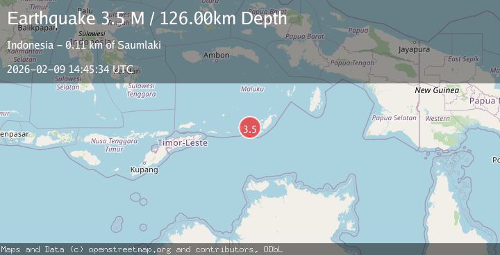
Earthquake Tanimbar Islands Region, Indonesia
Mon, 09 Feb 2026 14:45:34 GMT
Time1 hour ago
Location
-7.9282, 130.3385
Depth
126.0 KM
Event Summary
A 3.5 magnitude earthquake struck on Tanimbar Islands Region, Indonesia, at Mon, 09 Feb 2026 14:45:34 GMT. Depth: 125.998856km. Reviewed by BMKG seismologists, this minor quake occurred at a magnitude type of M.
Magnitude
3.5
M
Source
BMKG
Intensity
-
Agency Reports
1 Sources| Source | Magnitude | Depth | Time |
|---|---|---|---|
| BMKGPrimary | 3.5 | 126 km | 1 hour ago |
Earthquake Details
AutomaticEvent IDbmg2026cujv
Tsunami PotentialNo
Magnitude TypeM
Nearest Places
- Desa Nurnyaman33.3 km
- Nurnyaman33.6 km
- Desa Wiratan33.9 km
- Pulau Daweloor34.7 km
- Kecamatan Dawelor Dawera34.9 km
Comments
Join the discussion about this event.
Latest Earthquakes
2.1Mag
Sumbawa Region, Indonesia
Time1 hour ago
Depth32.33 km
SourceBMKG (Automatic)
2.2Mag
16 km ESE of Little Lake, CA
Time1 hour ago
Depth2.50 km
SourceUSGS (Automatic)
3.7Mag
HOKKAIDO, JAPAN REGION
Time1 hour ago
Depth0.00 km
SourceJMA (Automatic)
2.4Mag
42 km N of Petersville, Alaska
Time1 hour ago
Depth89.30 km
SourceUSGS (Automatic)
2.3Mag
Flores Sea
Time1 hour ago
Depth25.31 km
SourceBMKG (Automatic)
Nearby Earthquakes
5.9Mag
Tanimbar Islands Region, Indonesia
Time2 days ago
Depth100.00 km
SourceBMKG (Automatic)
4.2Mag
Tanimbar Islands Region, Indonesia
Time2 days ago
Depth137.60 km
SourceBMKG (Automatic)
3.5Mag
Tanimbar Islands Region, Indonesia
Time1 day ago
Depth105.26 km
SourceBMKG (Automatic)
3.6Mag
Tanimbar Islands Region, Indonesia
Time1 week ago
Depth224.21 km
SourceBMKG (Automatic)
5.0Mag
Tanimbar Islands Region, Indonesia
Time1 week ago
Depth28.16 km
SourceBMKG (Automatic)