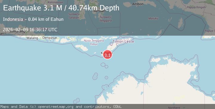
Earthquake Timor Region
Mon, 09 Feb 2026 16:36:18 GMT
Time1 hour ago
Location
-10.7113, 123.7887
Depth
21.9 KM
Event Summary
A 2.8 magnitude earthquake struck on Timor Region, at Mon, 09 Feb 2026 16:36:18 GMT. Depth: 21.899092km. Reviewed by BMKG seismologists, this minor quake occurred at a magnitude type of M.
Magnitude
2.8
M
Source
BMKG
Intensity
-
Agency Reports
1 Sources| Source | Magnitude | Depth | Time |
|---|---|---|---|
| BMKGPrimary | 2.8 | 22 km | 1 hour ago |
Earthquake Details
AutomaticEvent IDbmg2026cunm
Tsunami PotentialNo
Magnitude TypeM
Nearest Places
- Beatrice Reefs29.9 km
- Tanjung Fatupeu39.2 km
- Tanjung Tumbeno39.5 km
- Tanjung Bireo39.5 km
- Tanjung Anapasu39.5 km
Comments
Join the discussion about this event.
Latest Earthquakes
3.1Mag
Sumbawa Region, Indonesia
Time1 hour ago
Depth45.70 km
SourceBMKG (Automatic)
4.0Mag
OFFSHORE COQUIMBO, CHILE
Time1 hour ago
Depth26.40 km
SourceCSN (Automatic)
0.7Mag
8 km NW of The Geysers, CA
Time1 hour ago
Depth2.16 km
SourceUSGS (Automatic)
2.8Mag
Sumbawa Region, Indonesia
Time1 hour ago
Depth101.39 km
SourceBMKG (Automatic)
2.1Mag
Flores Sea
Time1 hour ago
Depth36.89 km
SourceBMKG (Automatic)
Nearby Earthquakes
3.9Mag
Timor Region
Time2 weeks ago
Depth48.21 km
SourceBMKG (Automatic)
2.8Mag
TIMOR REGION, INDONESIA
Time2 weeks ago
Depth26.00 km
SourceBMKG (Automatic)
2.8Mag
Timor Region
Time2 weeks ago
Depth6.89 km
SourceBMKG (Automatic)
2.5Mag
Timor Region
Time1 week ago
Depth13.32 km
SourceBMKG (Automatic)
2.8Mag
Timor Region
Time1 week ago
Depth28.52 km
SourceBMKG (Automatic)