Earthquake Northern Sumatra, Indonesia
Mon, 09 Feb 2026 18:50:14 GMT
Time1 hour ago
Location
3.4375, 97.2815
Depth
50.9 KM
Event Summary
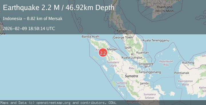
A 2.2 magnitude earthquake struck on Northern Sumatra, Indonesia, at Mon, 09 Feb 2026 18:50:14 GMT. Depth: 50.862263km. Reviewed by BMKG seismologists, this minor quake occurred at a magnitude type of M.
Magnitude
2.2
M
Source
BMKG
Intensity
-
Agency Reports
1 Sources| Source | Magnitude | Depth | Time |
|---|---|---|---|
| BMKGPrimary | 2.2 | 51 km | 1 hour ago |
Earthquake Details
AutomaticEvent IDbmg2026curx
Tsunami PotentialNo
Magnitude TypeM
Nearest Places
- Gampong Alur Keujrun2.8 km
- Pintulawang5.8 km
- Krueng Seibubung7.0 km
- Kecamatan Kluet Tengah7.8 km
- Tbaranbarieng10.2 km
Comments
Join the discussion about this event.
Latest Earthquakes
1.0Mag
2 km ESE of The Geysers, CA
Time1 hour ago
Depth1.10 km
SourceUSGS (Automatic)
1.4Mag
11 km W of Susitna, Alaska
Time1 hour ago
Depth53.80 km
SourceUSGS (Automatic)
2.8Mag
Northern Molucca Sea
Time1 hour ago
Depth36.54 km
SourceBMKG (Automatic)
2.1Mag
Sulawesi, Indonesia
Time1 hour ago
Depth5.00 km
SourceBMKG (Automatic)
2.6Mag
SAN JUAN, ARGENTINA
Time1 hour ago
Depth106.00 km
SourceNSNA (Automatic)
Nearby Earthquakes
2.4Mag
Northern Sumatra, Indonesia
Time3 days ago
Depth67.73 km
SourceBMKG (Automatic)
2.1Mag
Northern Sumatra, Indonesia
Time6 days ago
Depth26.66 km
SourceBMKG (Automatic)
2.0Mag
Northern Sumatra, Indonesia
Time3 days ago
Depth10.50 km
SourceBMKG (Automatic)
2.5Mag
Northern Sumatra, Indonesia
Time18 hours ago
Depth4.77 km
SourceBMKG (Automatic)
2.3Mag
Northern Sumatra, Indonesia
Time1 week ago
Depth6.40 km
SourceBMKG (Automatic)