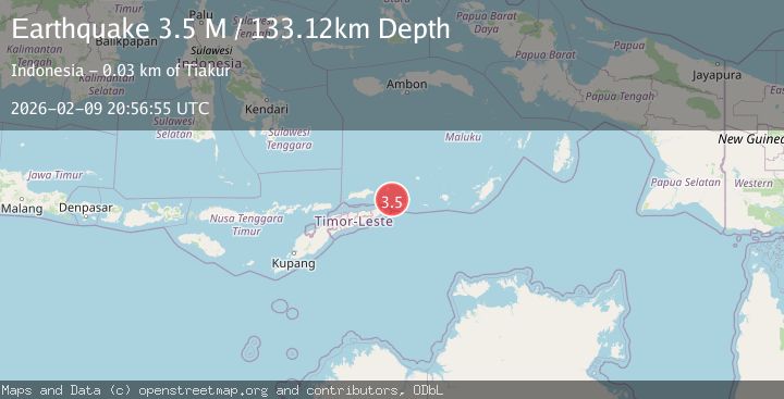
Earthquake Timor Region
Mon, 09 Feb 2026 20:56:57 GMT
Time1 hour ago
Location
-8.0285, 127.6262
Depth
78.1 KM
Event Summary
A 3.4 magnitude earthquake struck on Timor Region, at Mon, 09 Feb 2026 20:56:57 GMT. Depth: 78.121178km. Reviewed by BMKG seismologists, this minor quake occurred at a magnitude type of M.
Magnitude
3.4
M
Source
BMKG
Intensity
-
Agency Reports
1 Sources| Source | Magnitude | Depth | Time |
|---|---|---|---|
| BMKGPrimary | 3.4 | 78 km | 1 hour ago |
Earthquake Details
AutomaticEvent IDbmg2026cuwc
Tsunami PotentialNo
Magnitude TypeM
Nearest Places
- Serwaru15.7 km
- Tombra16.0 km
- Nuwewan17.4 km
- Desa Tutukey17.6 km
- Tanjung Jaulu17.7 km
Comments
Join the discussion about this event.
Latest Earthquakes
2.1Mag
WESTERN TEXAS
Time1 hour ago
Depth6.80 km
SourceTX (Automatic)
2.1Mag
Sulawesi, Indonesia
Time1 hour ago
Depth10.00 km
SourceBMKG (Automatic)
2.7Mag
Java, Indonesia
Time1 hour ago
Depth13.54 km
SourceBMKG (Automatic)
2.4Mag
Flores Sea
Time1 hour ago
Depth29.84 km
SourceBMKG (Automatic)
3.1Mag
MINDANAO, PHILIPPINES
Time1 hour ago
Depth9.00 km
SourcePIVS (Automatic)
Nearby Earthquakes
3.8Mag
Banda Sea
Time1 day ago
Depth126.89 km
SourceBMKG (Automatic)
3.9Mag
Banda Sea
Time2 weeks ago
Depth117.78 km
SourceBMKG (Automatic)
5.6Mag
Banda Sea
Time2 weeks ago
Depth179.61 km
SourceBMKG (Automatic)
4.2Mag
Timor Region
Time4 days ago
Depth78.50 km
SourceBMKG (Automatic)
3.7Mag
Banda Sea
Time2 weeks ago
Depth206.55 km
SourceBMKG (Automatic)