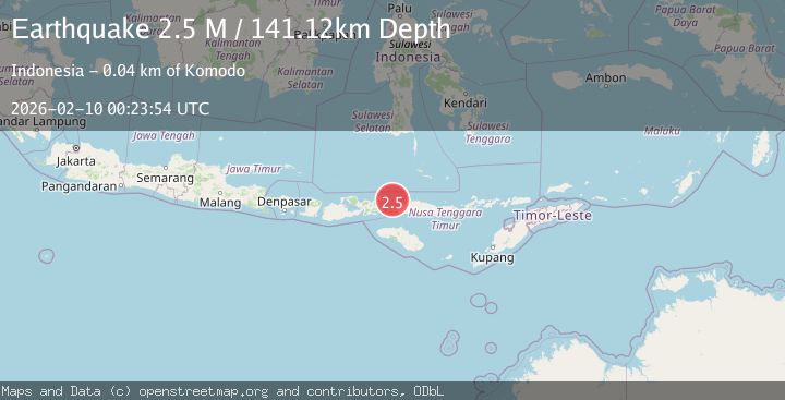
Earthquake Flores Region, Indonesia
Tue, 10 Feb 2026 00:23:54 GMT
Time1 hour ago
Location
-8.1725, 119.5613
Depth
138.6 KM
Event Summary
A 2.3 magnitude earthquake struck on Flores Region, Indonesia, at Tue, 10 Feb 2026 00:23:54 GMT. Depth: 138.61882km. Reviewed by BMKG seismologists, this minor quake occurred at a magnitude type of M.
Magnitude
2.3
M
Source
BMKG
Intensity
-
Agency Reports
1 Sources| Source | Magnitude | Depth | Time |
|---|---|---|---|
| BMKGPrimary | 2.3 | 139 km | 1 hour ago |
Earthquake Details
AutomaticEvent IDbmg2026cvcx
Tsunami PotentialNo
Magnitude TypeM
Nearest Places
- Toro Batumoncong30.9 km
- Gili Lawalaut30.9 km
- Loho Batumoncong32.5 km
- Gili Lawadarat33.1 km
- Teluk Gililawa33.2 km
Comments
Join the discussion about this event.
Latest Earthquakes
1.9Mag
14 km ESE of Pāhala, Hawaii
Time1 hour ago
Depth28.57 km
SourceUSGS (Automatic)
0.8Mag
2 km N of The Geysers, CA
Time1 hour ago
Depth1.30 km
SourceUSGS (Automatic)
1.8Mag
15 km ENE of Falls City, Texas
Time1 hour ago
Depth6.56 km
SourceUSGS (Automatic)
1.1Mag
7 km E of Fox, Alaska
Time1 hour ago
Depth0.20 km
SourceUSGS (Automatic)
3.3Mag
SIKKIM, INDIA
Time1 hour ago
Depth5.00 km
SourceNDI (Automatic)
Nearby Earthquakes
2.5Mag
Flores Region, Indonesia
Time2 weeks ago
Depth147.07 km
SourceBMKG (Automatic)
2.4Mag
Flores Region, Indonesia
Time1 week ago
Depth156.34 km
SourceBMKG (Automatic)
2.4Mag
Flores Region, Indonesia
Time2 days ago
Depth144.68 km
SourceBMKG (Automatic)
3.3Mag
Flores Region, Indonesia
Time1 week ago
Depth188.75 km
SourceBMKG (Automatic)
2.5Mag
Flores Region, Indonesia
Time2 weeks ago
Depth179.70 km
SourceBMKG (Automatic)