Earthquake Northern Molucca Sea
Tue, 10 Feb 2026 11:25:04 GMT
Time1 week ago
Location
2.2832, 127.7968
Depth
110.1 KM
Event Summary
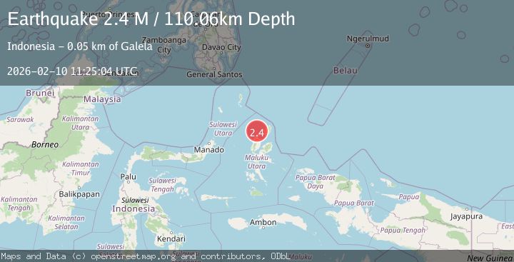
A 2.4 magnitude earthquake struck on Northern Molucca Sea, at Tue, 10 Feb 2026 11:25:04 GMT. Depth: 110.059502km. Reviewed by BMKG seismologists, this minor quake occurred at a magnitude type of M.
Magnitude
2.4
M
Source
BMKG
Intensity
-
Agency Reports
1 Sources| Source | Magnitude | Depth | Time |
|---|---|---|---|
| BMKGPrimary | 2.4 | 110 km | 1 week ago |
Earthquake Details
ManualEvent IDbmg2026cvys
Tsunami PotentialNo
Magnitude TypeM
Nearest Places
- Pulau Takurumagula0.9 km
- Ake Tutuere1.1 km
- Pulau Sedeng2.8 km
- Pulau Dua2.9 km
- Desa Cera3.1 km
Comments
Join the discussion about this event.
Latest Earthquakes
2.4Mag
Finland
Time2 minutes ago
Depth301.88 km
SourceVYT (Automatic)
1.2Mag
Alaska Peninsula
Time3 minutes ago
Depth0.12 km
SourceVYT (Automatic)
3.1Mag
DODECANESE IS.-TURKEY BORDER REG
Time9 minutes ago
Depth4.10 km
SourceKOERI (Automatic)
2.6Mag
NEAR COAST OF NICARAGUA
Time14 minutes ago
Depth38.00 km
SourceINET (Automatic)
1.4Mag
Central Alaska
Time17 minutes ago
Depth110.35 km
SourceVYT (Automatic)
Nearby Earthquakes
3.2Mag
Northern Molucca Sea
Time2 weeks ago
Depth227.49 km
SourceBMKG (Automatic)
3.1Mag
MOLUCCA SEA
Time1 month ago
Depth10.00 km
SourceBMKG (Automatic)
5.2Mag
MOLUCCA SEA
Time6 years ago
Depth80.00 km
SourceEMSC (Automatic)
3.2Mag
MOLUCCA SEA
Time1 month ago
Depth4.00 km
SourceBMKG (Automatic)
3.0Mag
MOLUCCA SEA
Time3 years ago
Depth10.00 km
SourceDJA (Automatic)