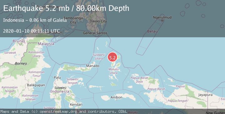
Earthquake MOLUCCA SEA
Fri, 10 Jan 2020 00:13:11 GMT
Time6 years ago
Location
2.3400, 127.6200
Depth
80.0 KM
Event Summary
A 5.2 magnitude earthquake struck on MOLUCCA SEA, at Fri, 10 Jan 2020 00:13:11 GMT. Depth: 80km. Reviewed by EMSC seismologists, this moderate quake occurred at a magnitude type of mb.
Magnitude
5.2
mb
Source
EMSC
Intensity
-
Agency Reports
1 Sources| Source | Magnitude | Depth | Time |
|---|---|---|---|
| EMSCPrimary | 5.2 | 80 km | 6 years ago |
Earthquake Details
AutomaticEvent IDemsc_EMSC_20200110_0000002
Tsunami PotentialNo
Magnitude Typemb
Nearest Places
- Pulau Deherete15.4 km
- Pulau Sedeng18.1 km
- Pulau Laba18.3 km
- Desa Cera18.5 km
- Tanjung Gurama19.7 km
Comments
Join the discussion about this event.
Latest Earthquakes
0.9Mag
8 km W of Cobb, CA
Time5 minutes ago
Depth1.53 km
SourceUSGS (Automatic)
1.8Mag
Central Alaska
Time8 minutes ago
Depth2.08 km
SourceVYT (Automatic)
2.9Mag
WESTERN TURKEY
Time11 minutes ago
Depth11.80 km
SourceKOERI (Automatic)
2.8Mag
Sulawesi, Indonesia
Time11 minutes ago
Depth21.08 km
SourceBMKG
4.0Mag
NEAR COAST OF NICARAGUA
Time15 minutes ago
Depth33.00 km
SourceINET (Automatic)
Nearby Earthquakes
3.0Mag
MOLUCCA SEA
Time4 years ago
Depth32.00 km
SourceDJA (Automatic)
3.0Mag
MOLUCCA SEA
Time3 years ago
Depth10.00 km
SourceDJA (Automatic)
4.0Mag
MOLUCCA SEA
Time2 years ago
Depth10.00 km
SourceBMKG (Automatic)
2.4Mag
Northern Molucca Sea
Time1 week ago
Depth110.06 km
SourceBMKG
3.0Mag
MOLUCCA SEA
Time5 years ago
Depth24.00 km
SourceDJA (Automatic)