Earthquake Northern Molucca Sea
Tue, 10 Feb 2026 12:00:20 GMT
Time1 week ago
Location
1.4782, 126.4045
Depth
76.7 KM
Event Summary
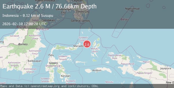
A 2.6 magnitude earthquake struck on Northern Molucca Sea, at Tue, 10 Feb 2026 12:00:20 GMT. Depth: 76.658386km. Reviewed by BMKG seismologists, this minor quake occurred at a magnitude type of M.
Magnitude
2.6
M
Source
BMKG
Intensity
-
Agency Reports
1 Sources| Source | Magnitude | Depth | Time |
|---|---|---|---|
| BMKGPrimary | 2.6 | 77 km | 1 week ago |
Earthquake Details
ManualEvent IDbmg2026cvzx
Tsunami PotentialNo
Magnitude TypeM
Nearest Places
- Kelurahan Mayau16.2 km
- Kelurahan Bido16.5 km
- Pulau Mayu17.1 km
- Kecamatan Pulau Batang Dua17.3 km
- Kelurahan Perum Bersatu17.5 km
Comments
Join the discussion about this event.
Latest Earthquakes
0.6Mag
6 km WNW of Cobb, CA
Time2 minutes ago
Depth1.83 km
SourceUSGS (Automatic)
0.7Mag
Northern Territory, Australia
Time4 minutes ago
Depth74.10 km
SourceVYT (Automatic)
2.1Mag
West Papua Region, Indonesia
Time5 minutes ago
Depth10.00 km
SourceBMKG
2.9Mag
LA RIOJA, ARGENTINA
Time7 minutes ago
Depth119.00 km
SourceNSNA (Automatic)
3.1Mag
Halmahera, Indonesia
Time11 minutes ago
Depth113.40 km
SourceVYT (Automatic)
Nearby Earthquakes
4.0Mag
MOLUCCA SEA
Time6 years ago
Depth10.00 km
SourceDJA (Automatic)
5.4Mag
MOLUCCA SEA
Time6 years ago
Depth10.00 km
SourceEMSC (Automatic)
3.0Mag
MOLUCCA SEA
Time1 year ago
Depth33.00 km
SourceBMKG (Automatic)
4.0Mag
MOLUCCA SEA
Time6 years ago
Depth10.00 km
SourceDJA (Automatic)
4.2Mag
Molucca Sea
Time1 week ago
Depth37.60 km
SourceVYT (Automatic)