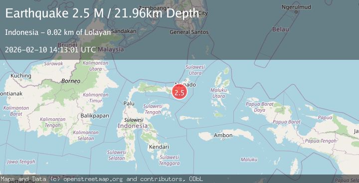
Earthquake Minahassa Peninsula, Sulawesi
Tue, 10 Feb 2026 14:13:01 GMT
Time1 week ago
Location
0.5100, 124.3386
Depth
22.0 KM
Event Summary
A 2.5 magnitude earthquake struck on Minahassa Peninsula, Sulawesi, at Tue, 10 Feb 2026 14:13:01 GMT. Depth: 21.964108km. Reviewed by BMKG seismologists, this minor quake occurred at a magnitude type of M.
Magnitude
2.5
M
Source
BMKG
Intensity
-
Agency Reports
1 Sources| Source | Magnitude | Depth | Time |
|---|---|---|---|
| BMKGPrimary | 2.5 | 22 km | 1 week ago |
Earthquake Details
ManualEvent IDbmg2026cweg
Tsunami PotentialNo
Magnitude TypeM
Nearest Places
- Desa Matandoi0.6 km
- Desa Matandoi Selatan2.7 km
- Desa Dumagin B3.3 km
- Bulud Tosilonan3.4 km
- Bulud Moyopang4.3 km
Comments
Join the discussion about this event.
Latest Earthquakes
0.8Mag
10 km WNW of The Geysers, CA
Time11 hours ago
Depth1.96 km
SourceUSGS (Automatic)
2.4Mag
Sumbawa region, Indonesia
Time11 hours ago
Depth111.45 km
SourceVYT (Automatic)
2.3Mag
NORTHERN CALIFORNIA
Time11 hours ago
Depth2.90 km
SourceNC (Automatic)
2.6Mag
Northern Sumatra, Indonesia
Time11 hours ago
Depth12.27 km
SourceBMKG
0.7Mag
30 km SSE of Knik River, Alaska
Time11 hours ago
Depth7.80 km
SourceUSGS (Automatic)
Nearby Earthquakes
5.4Mag
MINAHASA, SULAWESI, INDONESIA
Time3 years ago
Depth169.00 km
SourceEMSC (Automatic)
3.2Mag
Minahasa, Sulawesi, Indonesia
Time5 days ago
Depth96.07 km
SourceVYT (Automatic)
2.8Mag
MINAHASA, SULAWESI, INDONESIA
Time5 days ago
Depth133.00 km
SourceBMKG (Automatic)
3.0Mag
MINAHASA, SULAWESI, INDONESIA
Time4 years ago
Depth39.00 km
SourceDJA (Automatic)
5.1Mag
MINAHASA, SULAWESI, INDONESIA
Time8 years ago
Depth116.00 km
SourceEMSC (Automatic)