Earthquake Timor Sea
Tue, 10 Feb 2026 21:19:56 GMT
Time1 week ago
Location
-8.4375, 128.9177
Depth
146.8 KM
Event Summary
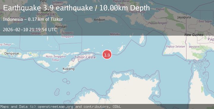
A 3.8 magnitude earthquake struck on Timor Sea, at Tue, 10 Feb 2026 21:19:56 GMT. Depth: 146.807419km. Reviewed by BMKG seismologists, this minor quake occurred at a magnitude type of M.
Magnitude
3.8
M
Source
BMKG
Intensity
-
Agency Reports
2 Sources| Source | Magnitude | Depth | Time |
|---|---|---|---|
| BMKGPrimary | 3.8 | 147 km | 1 week ago |
| VYT | 3.9 | 10 km | 1 week ago |
Earthquake Details
ManualEvent IDbmg2026cwsi
Tsunami PotentialNo
Magnitude TypeM
Nearest Places
- Teluk Lelang22.3 km
- Wetegai23.0 km
- Romkisar23.1 km
- Desa Regoha23.8 km
- Desa Lelang23.9 km
Comments
Join the discussion about this event.
Latest Earthquakes
1.3Mag
136 km SSE of McCarthy, Alaska
Time7 hours ago
Depth5.00 km
SourceUSGS (Automatic)
3.7Mag
offshore Coquimbo, Chile
Time7 hours ago
Depth0.00 km
SourceVYT (Automatic)
1.4Mag
EASTERN TURKEY
Time7 hours ago
Depth6.80 km
SourceAFAD (Automatic)
1.9Mag
6 km SW of Fuig, Puerto Rico
Time7 hours ago
Depth13.76 km
SourceUSGS
1.7Mag
northern Alaska
Time7 hours ago
Depth4.64 km
SourceVYT (Automatic)
Nearby Earthquakes
3.5Mag
Timor Sea
Time1 week ago
Depth182.50 km
SourceVYT (Automatic)
5.4Mag
KEPULAUAN BABAR, INDONESIA
Time16 years ago
Depth52.00 km
SourceEMSC (Automatic)
5.5Mag
KEPULAUAN BABAR, INDONESIA
Time15 years ago
Depth70.00 km
SourceEMSC (Automatic)
4.1Mag
Timor Sea
Time5 days ago
Depth180.66 km
SourceVYT (Automatic)
5.4Mag
KEPULAUAN BABAR, INDONESIA
Time20 years ago
Depth2.00 km
SourceEMSC (Automatic)