Earthquake Timor Sea
Tue, 10 Feb 2026 10:04:18 GMT
Time1 week ago
Location
-8.5002, 128.8508
Depth
182.5 KM
Event Summary
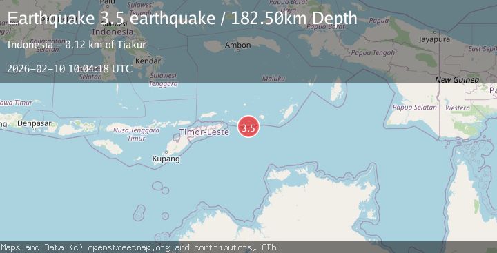
A 3.5 magnitude earthquake struck on Timor Sea, at Tue, 10 Feb 2026 10:04:18 GMT. Depth: 182.4951171875km. Reviewed by VYT seismologists, this minor quake occurred at a magnitude type of earthquake.
Magnitude
3.5
earthquake
Source
VYT
Intensity
-
Agency Reports
2 Sources| Source | Magnitude | Depth | Time |
|---|---|---|---|
| VYTPrimary | 3.5 | 182 km | 1 week ago |
| BMKG | 3.4 | 224 km | 1 week ago |
Earthquake Details
AutomaticEvent IDvyt_i5mpqqtndclk
Tsunami PotentialNo
Magnitude Typeearthquake
Nearest Places
- Romkisar30.0 km
- Teluk Lelang30.9 km
- Desa Rumkisar31.4 km
- Wetegai31.6 km
- Desa Lelang31.8 km
Comments
Join the discussion about this event.
Latest Earthquakes
1.4Mag
17 km S of Tres Pinos, CA
Time4 minutes ago
Depth5.12 km
SourceUSGS (Automatic)
1.8Mag
Southern Alaska
Time7 minutes ago
Depth0.00 km
SourceVYT (Automatic)
2.0Mag
Java, Indonesia
Time12 minutes ago
Depth5.00 km
SourceBMKG
0.7Mag
2 km SE of Loma Linda, CA
Time20 minutes ago
Depth3.87 km
SourceUSGS (Automatic)
2.3Mag
Sulawesi, Indonesia
Time22 minutes ago
Depth5.74 km
SourceBMKG
Nearby Earthquakes
3.8Mag
Timor Sea
Time1 week ago
Depth146.81 km
SourceBMKG
5.4Mag
KEPULAUAN BABAR, INDONESIA
Time16 years ago
Depth52.00 km
SourceEMSC (Automatic)
4.1Mag
Timor Sea
Time5 days ago
Depth180.66 km
SourceVYT (Automatic)
5.1Mag
TIMOR SEA
Time18 years ago
Depth20.00 km
SourceEMSC (Automatic)
5.0Mag
TIMOR SEA
Time17 years ago
Depth100.00 km
SourceEMSC (Automatic)