Earthquake West Papua Region, Indonesia
Wed, 11 Feb 2026 16:18:11 GMT
Time1 week ago
Location
-3.2005, 135.5404
Depth
10.0 KM
Event Summary
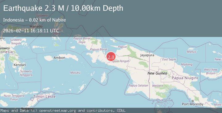
A 2.3 magnitude earthquake struck on West Papua Region, Indonesia, at Wed, 11 Feb 2026 16:18:11 GMT. Depth: 10km. Reviewed by BMKG seismologists, this minor quake occurred at a magnitude type of M.
Magnitude
2.3
M
Source
BMKG
Intensity
-
Agency Reports
1 Sources| Source | Magnitude | Depth | Time |
|---|---|---|---|
| BMKGPrimary | 2.3 | 10 km | 1 week ago |
Earthquake Details
ManualEvent IDbmg2026cydx
Tsunami PotentialNo
Magnitude TypeM
Nearest Places
- Tandjung Pinksteroost5.2 km
- Tanjung Boraitei5.6 km
- Ujung Kimbo6.3 km
- Kimi9.2 km
- Pulau Numini10.4 km
Comments
Join the discussion about this event.
Latest Earthquakes
3.8Mag
Atacama, Chile
Time7 hours ago
Depth113.40 km
SourceVYT (Automatic)
1.4Mag
Southeastern Alaska
Time7 hours ago
Depth0.00 km
SourceVYT (Automatic)
3.0Mag
northern Sumatra, Indonesia
Time7 hours ago
Depth10.50 km
SourceVYT (Automatic)
1.6Mag
Kenai Peninsula, Alaska
Time7 hours ago
Depth42.60 km
SourceVYT (Automatic)
2.4Mag
Finland
Time8 hours ago
Depth301.88 km
SourceVYT (Automatic)
Nearby Earthquakes
2.7Mag
PAPUA, INDONESIA
Time1 month ago
Depth18.00 km
SourceBMKG (Automatic)
2.7Mag
PAPUA, INDONESIA
Time3 weeks ago
Depth14.00 km
SourceBMKG (Automatic)
2.7Mag
West Papua Region, Indonesia
Time2 weeks ago
Depth10.00 km
SourceBMKG (Automatic)
3.1Mag
PAPUA, INDONESIA
Time1 month ago
Depth31.00 km
SourceBMKG (Automatic)
3.0Mag
PAPUA, INDONESIA
Time2 years ago
Depth10.00 km
SourceBMKG (Automatic)