Earthquake Bali Sea
Thu, 12 Feb 2026 16:19:08 GMT
Time1 week ago
Location
-7.8117, 117.5361
Depth
32.6 KM
Event Summary
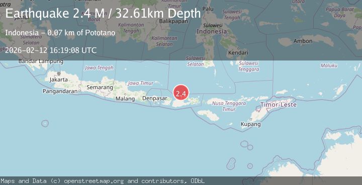
A 2.4 magnitude earthquake struck on Bali Sea, at Thu, 12 Feb 2026 16:19:08 GMT. Depth: 32.609737km. Reviewed by BMKG seismologists, this minor quake occurred at a magnitude type of M.
Magnitude
2.4
M
Source
BMKG
Intensity
-
Agency Reports
1 Sources| Source | Magnitude | Depth | Time |
|---|---|---|---|
| BMKGPrimary | 2.4 | 33 km | 1 week ago |
Earthquake Details
ManualEvent IDbmg2026czzl
Tsunami PotentialNo
Magnitude TypeM
Nearest Places
- 27.2 km
- 27.3 km
- 33.9 km
- 33.9 km
- 34.9 km
Comments
Join the discussion about this event.
Latest Earthquakes
1.2Mag
Fox Islands, Aleutian Islands, Alaska
Time19 hours ago
Depth7.08 km
SourceVYT (Automatic)
1.1Mag
4 km W of Lake Henshaw, CA
Time19 hours ago
Depth11.92 km
SourceUSGS (Automatic)
2.4Mag
Northern Territory, Australia
Time19 hours ago
Depth444.34 km
SourceVYT (Automatic)
3.2Mag
Northern Molucca Sea
Time19 hours ago
Depth35.14 km
SourceBMKG
1.3Mag
western Texas
Time19 hours ago
Depth12.33 km
SourceVYT (Automatic)
Nearby Earthquakes
3.0Mag
BALI SEA
Time5 years ago
Depth315.00 km
SourceDJA (Automatic)
2.2Mag
Bali Sea
Time2 weeks ago
Depth13.52 km
SourceBMKG (Automatic)
3.0Mag
BALI SEA
Time3 years ago
Depth305.00 km
SourceDJA (Automatic)
2.3Mag
Bali Sea
Time0 months ago
Depth10.00 km
SourceBMKG (Automatic)
2.5Mag
Bali Sea
Time3 weeks ago
Depth22.43 km
SourceBMKG (Automatic)