Earthquake Halmahera, Indonesia
Thu, 12 Feb 2026 18:30:52 GMT
Time6 days ago
Location
-0.2944, 129.5913
Depth
8.2 KM
Event Summary
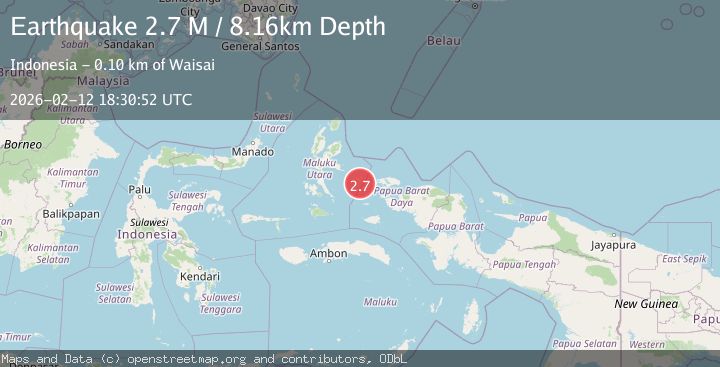
A 2.7 magnitude earthquake struck on Halmahera, Indonesia, at Thu, 12 Feb 2026 18:30:52 GMT. Depth: 8.15719km. Reviewed by BMKG seismologists, this minor quake occurred at a magnitude type of M.
Magnitude
2.7
M
Source
BMKG
Intensity
-
Agency Reports
1 Sources| Source | Magnitude | Depth | Time |
|---|---|---|---|
| BMKGPrimary | 2.7 | 8 km | 6 days ago |
Earthquake Details
ManualEvent IDbmg2026dadu
Tsunami PotentialNo
Magnitude TypeM
Nearest Places
- Tanjung Ilingelyo9.8 km
- Tanjung Ngetagelyo10.4 km
- Tanjung Magnonapo10.5 km
- Umera10.9 km
- Desa Umera13.7 km
Comments
Join the discussion about this event.
Latest Earthquakes
2.1Mag
Kenai Peninsula, Alaska
Time5 minutes ago
Depth14.77 km
SourceVYT (Automatic)
2.6Mag
Spain
Time5 minutes ago
Depth10.00 km
SourceVYT (Automatic)
4.1Mag
PORTUGAL
Time6 minutes ago
Depth14.60 km
SourceIPMA (Automatic)
1.6Mag
Alaska Peninsula
Time10 minutes ago
Depth15.63 km
SourceVYT (Automatic)
2.0Mag
Southern Sumatra, Indonesia
Time11 minutes ago
Depth22.20 km
SourceBMKG
Nearby Earthquakes
5.1Mag
HALMAHERA, INDONESIA
Time10 years ago
Depth10.00 km
SourceEMSC (Automatic)
4.0Mag
HALMAHERA, INDONESIA
Time1 year ago
Depth10.00 km
SourceBMKG (Automatic)
2.7Mag
Halmahera, Indonesia
Time2 weeks ago
Depth10.00 km
SourceBMKG (Automatic)
4.0Mag
HALMAHERA, INDONESIA
Time3 years ago
Depth10.00 km
SourceDJA (Automatic)
3.0Mag
Halmahera, Indonesia
Time4 days ago
Depth10.00 km
SourceBMKG