Earthquake South of Sumbawa, Indonesia
Fri, 13 Feb 2026 05:18:36 GMT
Time5 days ago
Location
-10.9006, 117.5421
Depth
10.0 KM
Event Summary
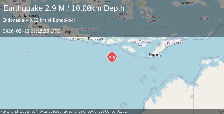
A 2.9 magnitude earthquake struck on South of Sumbawa, Indonesia, at Fri, 13 Feb 2026 05:18:36 GMT. Depth: 10km. Reviewed by BMKG seismologists, this minor quake occurred at a magnitude type of M.
Magnitude
2.9
M
Source
BMKG
Intensity
-
Agency Reports
1 Sources| Source | Magnitude | Depth | Time |
|---|---|---|---|
| BMKGPrimary | 2.9 | 10 km | 5 days ago |
Earthquake Details
ManualEvent IDbmg2026dazd
Tsunami PotentialNo
Magnitude TypeM
Nearest Places
- Tanjung Liongsong204.3 km
- Corona Bank204.3 km
- Tanjung Talonan206.0 km
- Tanjung Karosso206.2 km
- Lombok Basin206.2 km
Comments
Join the discussion about this event.
Latest Earthquakes
2.2Mag
Southeastern Alaska
Time3 minutes ago
Depth0.00 km
SourceVYT (Automatic)
1.6Mag
13 km SE of Balmorhea, Texas
Time5 minutes ago
Depth3.50 km
SourceUSGS (Automatic)
2.0Mag
Kenai Peninsula, Alaska
Time7 minutes ago
Depth51.51 km
SourceVYT (Automatic)
2.4Mag
Sumbawa Region, Indonesia
Time9 minutes ago
Depth103.46 km
SourceBMKG
2.5Mag
GREECE
Time16 minutes ago
Depth12.10 km
SourceNOA (Automatic)
Nearby Earthquakes
3.0Mag
SOUTH OF SUMBAWA, INDONESIA
Time4 years ago
Depth10.00 km
SourceDJA (Automatic)
3.2Mag
South of Sumbawa, Indonesia
Time1 week ago
Depth10.00 km
SourceBMKG (Automatic)
2.9Mag
South of Sumbawa, Indonesia
Time2 weeks ago
Depth23.49 km
SourceBMKG (Automatic)
4.0Mag
SOUTH OF SUMBAWA, INDONESIA
Time3 years ago
Depth10.00 km
SourceDJA (Automatic)
2.9Mag
South of Sumbawa, Indonesia
Time5 days ago
Depth34.48 km
SourceBMKG