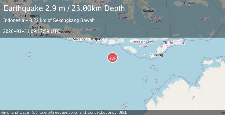
Earthquake South of Sumbawa, Indonesia
Sat, 31 Jan 2026 09:17:59 GMT
Time1 hour ago
Location
-10.8918, 117.3844
Depth
23.5 KM
Event Summary
A 2.9 magnitude earthquake struck on South of Sumbawa, Indonesia, at Sat, 31 Jan 2026 09:17:59 GMT. Depth: 23.491629km. Reviewed by BMKG seismologists, this minor quake occurred at a magnitude type of M.
Magnitude
2.9
M
Source
BMKG
Intensity
-
Agency Reports
1 Sources| Source | Magnitude | Depth | Time |
|---|---|---|---|
| BMKGPrimary | 2.9 | 23 km | 1 hour ago |
Earthquake Details
AutomaticEvent IDbmg2026cdnm
Tsunami PotentialNo
Magnitude TypeM
Nearest Places
- Lombok Basin191.8 km
- Tanjung Talonan201.1 km
- Tanu Tanjunglilin202.0 km
- Tanjung Sarang Ode202.7 km
- Tanjung Batubongkang202.9 km
Comments
Join the discussion about this event.
Latest Earthquakes
1.9Mag
6 km SSW of Independence, CA
Time1 hour ago
Depth6.34 km
SourceUSGS (Automatic)
3.3Mag
SAN JUAN, ARGENTINA
Time1 hour ago
Depth109.00 km
SourceNSNA (Automatic)
1.3Mag
2 km NNW of Banning, CA
Time2 hours ago
Depth9.62 km
SourceUSGS (Automatic)
1.3Mag
11 km NE of Coalinga, CA
Time2 hours ago
Depth11.59 km
SourceUSGS (Automatic)
2.3Mag
Java, Indonesia
Time2 hours ago
Depth35.50 km
SourceBMKG (Automatic)
Nearby Earthquakes
3.0Mag
SOUTH OF SUMBAWA, INDONESIA
Time4 days ago
Depth10.00 km
SourceBMKG (Automatic)
3.0Mag
South of Sumbawa, Indonesia
Time5 days ago
Depth35.20 km
SourceBMKG (Automatic)
3.8Mag
South of Sumbawa, Indonesia
Time2 days ago
Depth10.00 km
SourceBMKG (Automatic)
3.1Mag
South of Sumbawa, Indonesia
Time1 day ago
Depth10.00 km
SourceBMKG (Automatic)
3.3Mag
South of Sumbawa, Indonesia
Time4 days ago
Depth10.00 km
SourceBMKG (Automatic)