Earthquake Northern Sumatra, Indonesia
Fri, 13 Feb 2026 07:45:49 GMT
Time1 week ago
Location
4.1417, 97.4799
Depth
10.0 KM
Event Summary
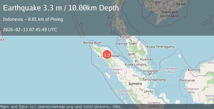
A 3.3 magnitude earthquake struck on Northern Sumatra, Indonesia, at Fri, 13 Feb 2026 07:45:49 GMT. Depth: 10km. Reviewed by BMKG seismologists, this minor quake occurred at a magnitude type of M.
Magnitude
3.3
M
Source
BMKG
Intensity
-
Agency Reports
1 Sources| Source | Magnitude | Depth | Time |
|---|---|---|---|
| BMKGPrimary | 3.3 | 10 km | 1 week ago |
Earthquake Details
ManualEvent IDbmg2026dbdz
Tsunami PotentialNo
Magnitude TypeM
Nearest Places
- Aer Putih1.9 km
- Gunung Aber4.7 km
- Burni Pasir Putih5.2 km
- Arul Pepelah5.5 km
- Arul Pepelah6.6 km
Comments
Join the discussion about this event.
Latest Earthquakes
1.1Mag
10 km WNW of The Geysers, CA
Time3 minutes ago
Depth2.07 km
SourceUSGS (Automatic)
1.6Mag
Southern Alaska
Time7 minutes ago
Depth0.12 km
SourceVYT (Automatic)
1.5Mag
Southeastern Alaska
Time10 minutes ago
Depth13.67 km
SourceVYT (Automatic)
4.8Mag
offshore Coquimbo, Chile
Time12 minutes ago
Depth0.00 km
SourceVYT (Automatic)
3.4Mag
Timor Region
Time12 minutes ago
Depth128.23 km
SourceBMKG
Nearby Earthquakes
4.1Mag
NORTHERN SUMATRA, INDONESIA
Time1 month ago
Depth2.00 km
SourceBMKG (Automatic)
2.8Mag
Northern Sumatra, Indonesia
Time0 months ago
Depth5.00 km
SourceBMKG (Automatic)
2.4Mag
Northern Sumatra, Indonesia
Time1 week ago
Depth5.00 km
SourceBMKG (Automatic)
3.0Mag
NORTHERN SUMATRA, INDONESIA
Time4 months ago
Depth10.00 km
SourceBMKG (Automatic)
3.0Mag
NORTHERN SUMATRA, INDONESIA
Time3 months ago
Depth10.00 km
SourceBMKG (Automatic)