Earthquake Northern Sumatra, Indonesia
Sun, 08 Feb 2026 18:44:24 GMT
Time4 hours ago
Location
4.1341, 97.4017
Depth
5.0 KM
Event Summary
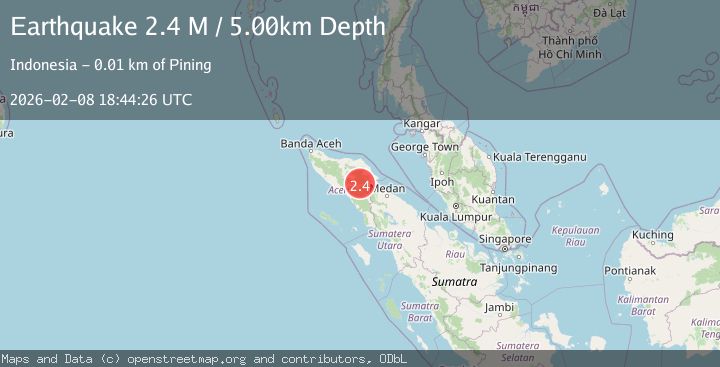
A 2.3 magnitude earthquake struck on Northern Sumatra, Indonesia, at Sun, 08 Feb 2026 18:44:24 GMT. Depth: 5km. Reviewed by BMKG seismologists, this minor quake occurred at a magnitude type of M.
Magnitude
2.3
M
Source
BMKG
Intensity
-
Agency Reports
1 Sources| Source | Magnitude | Depth | Time |
|---|---|---|---|
| BMKGPrimary | 2.3 | 5 km | 4 hours ago |
Earthquake Details
AutomaticEvent IDbmg2026cswf
Tsunami PotentialNo
Magnitude TypeM
Nearest Places
- Burni Apitan1.0 km
- Burni Gajah2.7 km
- Burni Siluman2.8 km
- Burni Pepelar3.0 km
- Burni Kacang Minyak3.7 km
Comments
Join the discussion about this event.
Latest Earthquakes
1.7Mag
56 km SSE of King Salmon, Alaska
Time4 hours ago
Depth5.00 km
SourceUSGS (Automatic)
2.4Mag
CZECH REPUBLIC
Time4 hours ago
Depth1.00 km
SourceGFZ (Automatic)
2.7Mag
Northern Sumatra, Indonesia
Time4 hours ago
Depth129.20 km
SourceBMKG (Automatic)
2.1Mag
Minahassa Peninsula, Sulawesi
Time4 hours ago
Depth9.40 km
SourceBMKG (Automatic)
4.1Mag
Northwest of Australia
Time4 hours ago
Depth5.00 km
SourceBMKG (Automatic)
Nearby Earthquakes
2.9Mag
Northern Sumatra, Indonesia
Time2 days ago
Depth3.00 km
SourceBMKG (Automatic)
2.2Mag
Northern Sumatra, Indonesia
Time2 weeks ago
Depth2.00 km
SourceBMKG (Automatic)
3.4Mag
Northern Sumatra, Indonesia
Time1 week ago
Depth3.00 km
SourceBMKG (Automatic)
2.9Mag
Northern Sumatra, Indonesia
Time12 hours ago
Depth1.00 km
SourceBMKG (Automatic)
2.2Mag
Northern Sumatra, Indonesia
Time1 day ago
Depth3.77 km
SourceBMKG (Automatic)