Earthquake Minahassa Peninsula, Sulawesi
Fri, 13 Feb 2026 14:24:35 GMT
Time6 days ago
Location
0.0315, 119.6296
Depth
6.0 KM
Event Summary
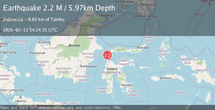
A 2.2 magnitude earthquake struck on Minahassa Peninsula, Sulawesi, at Fri, 13 Feb 2026 14:24:35 GMT. Depth: 5.966872km. Reviewed by BMKG seismologists, this minor quake occurred at a magnitude type of M.
Magnitude
2.2
M
Source
BMKG
Intensity
-
Agency Reports
1 Sources| Source | Magnitude | Depth | Time |
|---|---|---|---|
| BMKGPrimary | 2.2 | 6 km | 6 days ago |
Earthquake Details
ManualEvent IDbmg2026dbrd
Tsunami PotentialNo
Magnitude TypeM
Nearest Places
- Tanjung Biro4.2 km
- Bulu Ulok4.5 km
- Tanjung Manimbaya4.9 km
- Manimbaya5.1 km
- Bulu Jolovani5.2 km
Comments
Join the discussion about this event.
Latest Earthquakes
3.0Mag
Tarapaca, Chile
Time1 minute ago
Depth110.47 km
SourceVYT (Automatic)
2.2Mag
northern Colombia
Time3 minutes ago
Depth153.69 km
SourceVYT (Automatic)
1.0Mag
8 km W of Cobb, CA
Time8 minutes ago
Depth2.02 km
SourceUSGS (Automatic)
1.8Mag
Southeastern Alaska
Time10 minutes ago
Depth16.72 km
SourceVYT (Automatic)
3.1Mag
AEGEAN SEA
Time13 minutes ago
Depth13.50 km
SourceKOERI (Automatic)
Nearby Earthquakes
2.7Mag
Minahassa Peninsula, Sulawesi
Time1 week ago
Depth5.00 km
SourceBMKG
5.7Mag
MINAHASA, SULAWESI, INDONESIA
Time7 years ago
Depth10.00 km
SourceEMSC (Automatic)
3.0Mag
MINAHASA, SULAWESI, INDONESIA
Time3 years ago
Depth17.00 km
SourceDJA (Automatic)
5.1Mag
MINAHASA, SULAWESI, INDONESIA
Time7 years ago
Depth10.00 km
SourceEMSC (Automatic)
2.4Mag
Minahassa Peninsula, Sulawesi
Time6 days ago
Depth5.00 km
SourceBMKG