Earthquake Southeastern Alaska
Fri, 20 Feb 2026 06:39:04 GMT
Time1 hour ago
Location
60.4935, -139.8094
Depth
16.7 KM
Event Summary
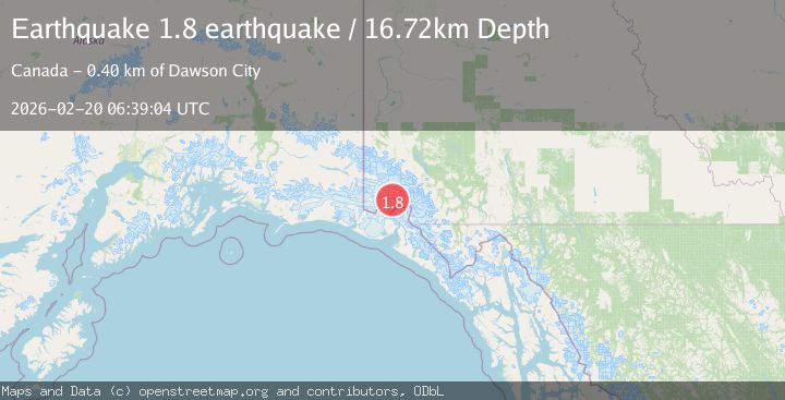
A 1.8 magnitude earthquake struck on Southeastern Alaska, at Fri, 20 Feb 2026 06:39:04 GMT. Depth: 16.7236328125km. Reviewed by VYT seismologists, this minor quake occurred at a magnitude type of earthquake.
Magnitude
1.8
earthquake
Source
VYT
Intensity
-
Agency Reports
1 Sources| Source | Magnitude | Depth | Time |
|---|---|---|---|
| VYTPrimary | 1.8 | 17 km | 1 hour ago |
Earthquake Details
AutomaticEvent IDvyt_o1bvmao7xnpc
Tsunami PotentialNo
Magnitude Typeearthquake
Nearest Places
- Mount King George4.4 km
- Marker Lake10.0 km
- Mount Queen Mary15.7 km
- Mount Vancouver16.2 km
- St. Elias Mountains19.6 km
Comments
Join the discussion about this event.
Latest Earthquakes
1.9Mag
Southeastern Alaska
Time1 hour ago
Depth7.08 km
SourceVYT (Automatic)
1.3Mag
Central Alaska
Time1 hour ago
Depth116.58 km
SourceVYT (Automatic)
3.7Mag
Antofagasta, Chile
Time1 hour ago
Depth123.17 km
SourceVYT (Automatic)
1.3Mag
8 km SSE of Coahoma, Texas
Time1 hour ago
Depth3.83 km
SourceUSGS (Automatic)
1.8Mag
Southeastern Alaska
Time1 hour ago
Depth17.46 km
SourceVYT (Automatic)
Nearby Earthquakes
3.0Mag
SOUTHERN YUKON TERRITORY, CANADA
Time2 months ago
Depth14.90 km
SourceAK (Automatic)
3.0Mag
SOUTHERN YUKON TERRITORY, CANADA
Time2 months ago
Depth7.10 km
SourceAK (Automatic)
4.0Mag
SOUTHERN YUKON TERRITORY, CANADA
Time2 weeks ago
Depth5.20 km
SourceAK (Automatic)
4.6Mag
SOUTHERN YUKON TERRITORY, CANADA
Time1 month ago
Depth3.80 km
SourceEMSC (Automatic)
3.3Mag
SOUTHERN YUKON TERRITORY, CANADA
Time1 month ago
Depth5.00 km
SourceAK (Automatic)