Earthquake Bali Sea
Sat, 14 Feb 2026 08:47:17 GMT
Time4 days ago
Location
-7.8906, 117.3802
Depth
16.0 KM
Event Summary
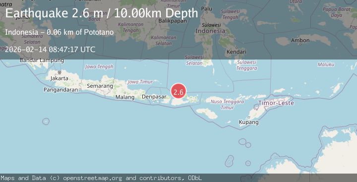
A 2.6 magnitude earthquake struck on Bali Sea, at Sat, 14 Feb 2026 08:47:17 GMT. Depth: 16.028297km. Reviewed by BMKG seismologists, this minor quake occurred at a magnitude type of M.
Magnitude
2.6
M
Source
BMKG
Intensity
-
Agency Reports
1 Sources| Source | Magnitude | Depth | Time |
|---|---|---|---|
| BMKGPrimary | 2.6 | 10 km | 4 days ago |
Earthquake Details
ManualEvent IDbmg2026ddbn
Tsunami PotentialNo
Magnitude TypeM
Nearest Places
- Gosong Sakunci21.3 km
- Pulau Sadapur23.4 km
- Desa Bajo Medang27.4 km
- Desa Bugis Medang27.7 km
- Tanjung Timor27.9 km
Comments
Join the discussion about this event.
Latest Earthquakes
2.1Mag
Tarapaca, Chile
Time9 hours ago
Depth8.18 km
SourceVYT (Automatic)
1.4Mag
12 km ESE of Olancha, CA
Time9 hours ago
Depth7.15 km
SourceUSGS (Automatic)
2.8Mag
northwestern Russia
Time9 hours ago
Depth10.00 km
SourceVYT (Automatic)
3.3Mag
Near North Coast of West Papua
Time9 hours ago
Depth10.00 km
SourceBMKG
1.2Mag
5 km NNE of Fishhook, Alaska
Time9 hours ago
Depth0.80 km
SourceUSGS (Automatic)