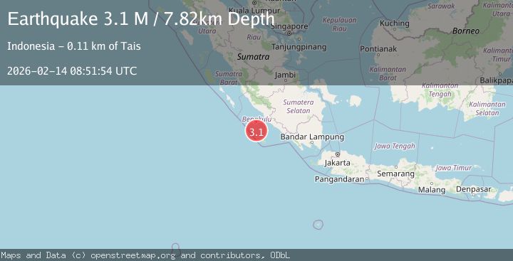
Earthquake Southern Sumatra, Indonesia
Sat, 14 Feb 2026 08:51:54 GMT
Time5 days ago
Location
-4.7205, 101.8278
Depth
7.8 KM
Event Summary
A 3.1 magnitude earthquake struck on Southern Sumatra, Indonesia, at Sat, 14 Feb 2026 08:51:54 GMT. Depth: 7.81586km. Reviewed by BMKG seismologists, this minor quake occurred at a magnitude type of M.
Magnitude
3.1
M
Source
BMKG
Intensity
-
Agency Reports
1 Sources| Source | Magnitude | Depth | Time |
|---|---|---|---|
| BMKGPrimary | 3.1 | 8 km | 5 days ago |
Earthquake Details
ManualEvent IDbmg2026ddbr
Tsunami PotentialNo
Magnitude TypeM
Nearest Places
- Sungai Hubaje72.7 km
- Lakoaha72.7 km
- Tanjung Lakoaha72.8 km
- Batang Mea74.4 km
- Barhau75.0 km
Comments
Join the discussion about this event.
Latest Earthquakes
2.1Mag
Sumbawa Region, Indonesia
Time3 hours ago
Depth10.00 km
SourceBMKG
2.6Mag
Ceram Sea
Time3 hours ago
Depth31.11 km
SourceBMKG
1.1Mag
WESTERN TURKEY
Time3 hours ago
Depth6.90 km
SourceAFAD (Automatic)
1.1Mag
Alaska Peninsula
Time3 hours ago
Depth0.00 km
SourceVYT (Automatic)
2.9Mag
CENTRAL TURKEY
Time3 hours ago
Depth5.60 km
SourceKOERI (Automatic)
Nearby Earthquakes
4.0Mag
SOUTHERN SUMATRA, INDONESIA
Time4 months ago
Depth10.00 km
SourceBMKG (Automatic)
5.0Mag
SOUTHERN SUMATRA, INDONESIA
Time3 years ago
Depth40.00 km
SourceEMSC (Automatic)
3.0Mag
SOUTHERN SUMATRA, INDONESIA
Time1 month ago
Depth16.00 km
SourceBMKG (Automatic)
3.3Mag
SOUTHERN SUMATRA, INDONESIA
Time1 month ago
Depth10.00 km
SourceBMKG (Automatic)
3.2Mag
Southern Sumatra, Indonesia
Time3 weeks ago
Depth10.00 km
SourceBMKG (Automatic)