Earthquake West Papua Region, Indonesia
Sat, 14 Feb 2026 23:45:09 GMT
Time1 week ago
Location
-0.5793, 131.2491
Depth
10.0 KM
Event Summary
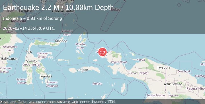
A 2.2 magnitude earthquake struck on West Papua Region, Indonesia, at Sat, 14 Feb 2026 23:45:09 GMT. Depth: 10km. Reviewed by BMKG seismologists, this minor quake occurred at a magnitude type of M.
Magnitude
2.2
M
Source
BMKG
Intensity
-
Agency Reports
1 Sources| Source | Magnitude | Depth | Time |
|---|---|---|---|
| BMKGPrimary | 2.2 | 10 km | 1 week ago |
Earthquake Details
ManualEvent IDbmg2026defd
Tsunami PotentialNo
Magnitude TypeM
Nearest Places
- 19.9 km
- 20.4 km
- 22.9 km
- 23.7 km
- 24.6 km
Comments
Join the discussion about this event.
Latest Earthquakes
1.2Mag
Central California
Time5 minutes ago
Depth11.11 km
SourceVYT (Automatic)
2.0Mag
NEVADA
Time5 minutes ago
Depth4.20 km
SourceNN (Automatic)
2.2Mag
Southern Alaska
Time11 minutes ago
Depth146.61 km
SourceVYT (Automatic)
1.5Mag
Central Alaska
Time12 minutes ago
Depth0.00 km
SourceVYT (Automatic)
3.5Mag
SOUTH OF KERMADEC ISLANDS
Time18 minutes ago
Depth300.00 km
SourceGNS (Automatic)
Nearby Earthquakes
2.3Mag
West Papua Region, Indonesia
Time3 weeks ago
Depth10.00 km
SourceBMKG (Automatic)
3.0Mag
NEAR N COAST OF PAPUA, INDONESIA
Time7 months ago
Depth13.00 km
SourceBMKG (Automatic)
3.0Mag
NEAR N COAST OF PAPUA, INDONESIA
Time3 years ago
Depth10.00 km
SourceDJA (Automatic)
2.6Mag
NEAR N COAST OF PAPUA, INDONESIA
Time1 month ago
Depth10.00 km
SourceBMKG (Automatic)
3.0Mag
NEAR N COAST OF PAPUA, INDONESIA
Time2 years ago
Depth11.00 km
SourceBMKG (Automatic)