Earthquake West Papua Region, Indonesia
Sun, 01 Feb 2026 05:10:12 GMT
Time3 days ago
Location
-0.6055, 131.2652
Depth
10.0 KM
Event Summary
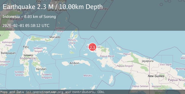
A 2.3 magnitude earthquake struck on West Papua Region, Indonesia, at Sun, 01 Feb 2026 05:10:12 GMT. Depth: 10km. Reviewed by BMKG seismologists, this minor quake occurred at a magnitude type of M.
Magnitude
2.3
M
Source
BMKG
Intensity
-
Agency Reports
1 Sources| Source | Magnitude | Depth | Time |
|---|---|---|---|
| BMKGPrimary | 2.3 | 10 km | 3 days ago |
Earthquake Details
AutomaticEvent IDbmg2026cfav
Tsunami PotentialNo
Magnitude TypeM
Nearest Places
- Pulau Wayam22.9 km
- Pulau Wayam23.3 km
- Distrik Maladum Mes23.9 km
- Kelurahan Tanjung Kasuari24.0 km
- Kelurahan Saoka24.2 km
Comments
Join the discussion about this event.
Latest Earthquakes
0.6Mag
5 km SW of Idyllwild, CA
Time9 minutes ago
Depth16.76 km
SourceUSGS (Automatic)
2.1Mag
Flores Region, Indonesia
Time14 minutes ago
Depth97.78 km
SourceBMKG (Automatic)
2.1Mag
12 km NW of Fishhook, Alaska
Time16 minutes ago
Depth22.90 km
SourceUSGS (Automatic)
2.9Mag
Bali Sea
Time29 minutes ago
Depth16.06 km
SourceBMKG (Automatic)
2.7Mag
West Papua Region, Indonesia
Time35 minutes ago
Depth10.00 km
SourceBMKG (Automatic)
Nearby Earthquakes
2.1Mag
West Papua Region, Indonesia
Time4 hours ago
Depth15.25 km
SourceBMKG (Automatic)
2.3Mag
West Papua Region, Indonesia
Time1 week ago
Depth10.00 km
SourceBMKG (Automatic)
2.2Mag
West Papua Region, Indonesia
Time1 week ago
Depth10.00 km
SourceBMKG (Automatic)
2.2Mag
West Papua Region, Indonesia
Time1 week ago
Depth10.00 km
SourceBMKG (Automatic)
2.3Mag
West Papua Region, Indonesia
Time1 week ago
Depth10.00 km
SourceBMKG (Automatic)