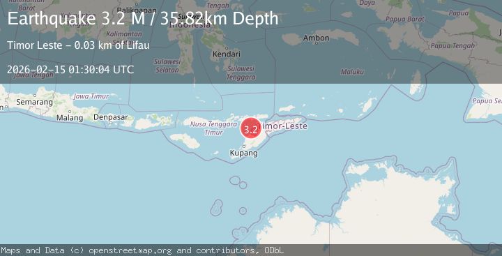
Earthquake Timor Region
Sun, 15 Feb 2026 01:30:04 GMT
Time4 days ago
Location
-9.0074, 124.0762
Depth
35.8 KM
Event Summary
A 3.2 magnitude earthquake struck on Timor Region, at Sun, 15 Feb 2026 01:30:04 GMT. Depth: 35.816433km. Reviewed by BMKG seismologists, this minor quake occurred at a magnitude type of M.
Magnitude
3.2
M
Source
BMKG
Intensity
-
Agency Reports
1 Sources| Source | Magnitude | Depth | Time |
|---|---|---|---|
| BMKGPrimary | 3.2 | 36 km | 4 days ago |
Earthquake Details
ManualEvent IDbmg2026deip
Tsunami PotentialNo
Magnitude TypeM
Nearest Places
- Point Panamtasa29.6 km
- River Oenis29.6 km
- River Namun29.8 km
- Fuabana30.2 km
- Point Bokon30.2 km
Comments
Join the discussion about this event.
Latest Earthquakes
1.4Mag
Kenai Peninsula, Alaska
Time4 minutes ago
Depth1.95 km
SourceVYT (Automatic)
3.1Mag
Northern Sumatra, Indonesia
Time4 minutes ago
Depth14.69 km
SourceBMKG
1.9Mag
Channel Islands region, California
Time5 minutes ago
Depth2.81 km
SourceVYT (Automatic)
3.3Mag
Southern Alaska
Time12 minutes ago
Depth13.06 km
SourceVYT (Automatic)
1.9Mag
Southern Yukon Territory, Canada
Time12 minutes ago
Depth0.00 km
SourceVYT (Automatic)
Nearby Earthquakes
3.0Mag
KEPULAUAN ALOR, INDONESIA
Time2 years ago
Depth46.00 km
SourceBMKG (Automatic)
5.2Mag
TIMOR REGION
Time17 years ago
Depth120.00 km
SourceEMSC (Automatic)
3.6Mag
TIMOR REGION
Time1 month ago
Depth57.00 km
SourceBMKG (Automatic)
4.0Mag
TIMOR REGION
Time7 months ago
Depth58.00 km
SourceBMKG (Automatic)
5.7Mag
KEPULAUAN ALOR, INDONESIA
Time17 years ago
Depth10.00 km
SourceEMSC (Automatic)