Earthquake Southern Alaska
Thu, 19 Feb 2026 09:19:52 GMT
Time1 hour ago
Location
61.4443, -148.0766
Depth
28.1 KM
Event Summary
A 3.2 magnitude earthquake struck on Southern Alaska, at Thu, 19 Feb 2026 09:19:52 GMT. Depth: 28.076171875km. Reviewed by VYT seismologists, this minor quake occurred at a magnitude type of earthquake.
Magnitude
3.2
earthquake
Source
VYT
Intensity
-
Agency Reports
1 Sources| Source | Magnitude | Depth | Time |
|---|---|---|---|
| VYTPrimary | 3.2 | 28 km | 1 hour ago |
Earthquake Details
AutomaticEvent IDvyt_lro5c75bjoiz
Tsunami PotentialNo
Magnitude Typeearthquake
Nearest Places
- Marcus Baker Glacier4.2 km
- Marcus Baker Glacier11.0 km
- Mount Goode14.0 km
- Knik Glacier14.6 km
- Grasshopper Valley15.7 km
Comments
Join the discussion about this event.
Latest Earthquakes
1.9Mag
Southern Yukon Territory, Canada
Time1 hour ago
Depth0.00 km
SourceVYT (Automatic)
2.2Mag
western Texas
Time1 hour ago
Depth2.69 km
SourceVYT (Automatic)
2.1Mag
Southern Alaska
Time1 hour ago
Depth0.00 km
SourceVYT (Automatic)
2.2Mag
Dead Sea region
Time1 hour ago
Depth1.95 km
SourceVYT (Automatic)
1.5Mag
49 km W of Mentone, Texas
Time1 hour ago
Depth3.29 km
SourceUSGS (Automatic)
Nearby Earthquakes
2.5Mag
40 km SSE of Chickaloon, Alaska
Time2 weeks ago
Depth21.00 km
SourceUSGS (Automatic)
1.6Mag
Southern Alaska
Time3 days ago
Depth13.79 km
SourceVYT (Automatic)
1.8Mag
Southern Alaska
Time2 hours ago
Depth0.00 km
SourceVYT (Automatic)
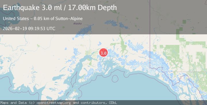
3.0Mag
SOUTHERN ALASKA
Time9 years ago
Depth17.00 km
SourceNEIR (Automatic)
2.1Mag
42 km ESE of Knik River, Alaska
Time2 weeks ago
Depth29.20 km
SourceUSGS (Automatic)