Earthquake Southern Sumatra, Indonesia
Sun, 15 Feb 2026 05:16:21 GMT
Time3 days ago
Location
-5.9981, 103.8697
Depth
1.6 KM
Event Summary
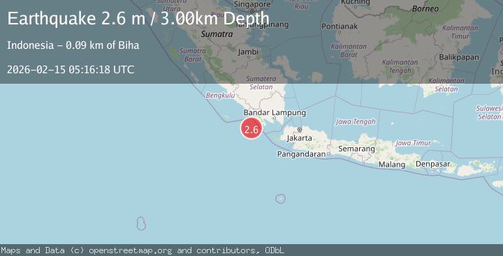
A 2.6 magnitude earthquake struck on Southern Sumatra, Indonesia, at Sun, 15 Feb 2026 05:16:21 GMT. Depth: 1.603566km. Reviewed by BMKG seismologists, this minor quake occurred at a magnitude type of M.
Magnitude
2.6
M
Source
BMKG
Intensity
-
Agency Reports
1 Sources| Source | Magnitude | Depth | Time |
|---|---|---|---|
| BMKGPrimary | 2.6 | 3 km | 3 days ago |
Earthquake Details
ManualEvent IDbmg2026deqb
Tsunami PotentialNo
Magnitude TypeM
Nearest Places
- Enggano Basin13.2 km
- Cukuh Batuberagam63.0 km
- Teluk Bengkunat63.8 km
- Wai Heni64.2 km
- Ujung Siging64.4 km
Comments
Join the discussion about this event.
Latest Earthquakes
2.7Mag
West Papua Region, Indonesia
Time2 minutes ago
Depth45.68 km
SourceBMKG
2.6Mag
Java, Indonesia
Time12 minutes ago
Depth214.22 km
SourceBMKG
1.0Mag
Southeastern Alaska
Time12 minutes ago
Depth0.00 km
SourceVYT (Automatic)
3.5Mag
COOK STRAIT, NEW ZEALAND
Time13 minutes ago
Depth75.30 km
SourceGNS (Automatic)
2.5Mag
Seram, Indonesia
Time15 minutes ago
Depth21.28 km
SourceBMKG
Nearby Earthquakes
2.5Mag
SOUTHWEST OF SUMATRA, INDONESIA
Time1 month ago
Depth0.00 km
SourceBMKG (Automatic)
5.4Mag
SOUTHWEST OF SUMATRA, INDONESIA
Time10 years ago
Depth60.00 km
SourceEMSC (Automatic)
3.4Mag
SOUTHWEST OF SUMATRA, INDONESIA
Time1 month ago
Depth9.00 km
SourceBMKG (Automatic)
3.0Mag
SOUTHERN SUMATRA, INDONESIA
Time2 years ago
Depth10.00 km
SourceDJA (Automatic)
5.5Mag
SOUTHWEST OF SUMATRA, INDONESIA
Time20 years ago
Depth33.00 km
SourceEMSC (Automatic)